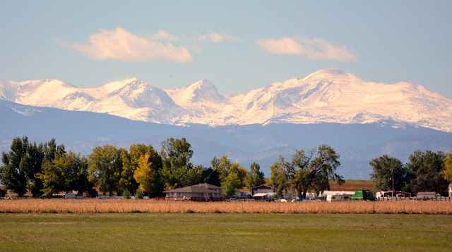
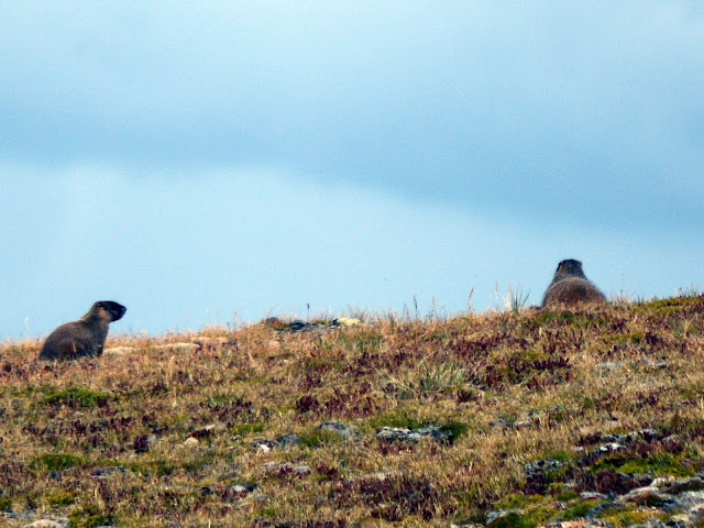
We're back on the Trail Ridge Road in Rocky Mountain National Park again in this post. My husband and I drove this road from the Eastern entrance all the way to the western exit/entrance of the park in early September, exactly one week before the horrible flooding that occurred in northern Colorado. Trail Ridge Road (US 34) is the highest continuously paved road in the United States, beginning in Estes Park, passing through Rocky Mountain National Park, and ending in Grand Lake, Colorado. To see part one of my posts about Trail Ridge Road click here, and to see part two click here.
In my last post about the Trail Ridge Road, we left the "Roof of the Rockies," after our hike on the tundra trail, and we are now headed west toward the Alpine Center. (All photos and photo collages in this post will enlarge if clicked on once, and then enlarge to full size if clicked on again)
We are still in the tundra area, at an elevation over 12,000 feet!
Our next stop was tour number seven -"Lava Cliffs," at 12,080 feet elevation. If you remember from my first post about Trail Ridge Road, I am using a companion booklet I bought in the Rocky Mountain National Park visitors center called "Guide to Trail Ridge Road," which gives us a brief description of what we are looking at for each scenic stop.
The lava cliffs were formed between 29 million and 24 million years ago. That is an age I find hard to wrap my mind around! Volcanoes had erupted repeatedly in mountains eight miles to the west and deposits of volcanic ash and debris formed the rock we see here.
The highest point on Trail Ridge Road is located at 12,183 feet between Lava Cliffs and the Gorge Range Overlook. The Gorge Range Overlook is a tundra protected area and offers views of the Gore Range which are 60 miles away. Click on the photo to read more about the range.
Stop number 8 on the Trail Ridge Road tour was at 11,796 feet--the Alpine Visitor Center. The Alpine Center is located at Fall River Pass, the dividing point between the Fall River and Cache la Poudre River drainages. The rivers later meet in Greeley, Colorado, and join for the journey to the Gulf of Mexico through Platte, Missouri and Mississippi river drainages.
 I took this photo, of a photo of the Alpine Visitor Center in winter that was inside the center. (Click to enlarge and then click again to read it full size) The Alpine Visitor center is buffeted by extreme winds, especially in winter. The heavy logs on the roof support the structure's roof and catch snow, which helps prevent the roof shingles from being blown away. You can see how high the snowfall accumulation can be from this photo! Most of the high elevations of the Trail Ridge Road are closed during late fall into late Spring until the snow melts enough to be plowed and the danger of blizzards is past.
We stopped at the Alpine Center to have lunch, and shop at the Trail Ridge store to look at souvenirs. We also enjoyed a nature exhibit and ranger talk, and all the magnificent views we saw, both from our window seats in the self serve cafe and the outside veranda. At one point the skies opened up with a heavy rainstorm.
From the Alpine Center's veranda, you can see the Glacial Cirque which was formed by glaciers that were once hundreds of feet deep. As the glaciers slid downward over two million years they scooped out this bowl-shaped cirque and formed a "U" shaped valley below.
This placard explains why the Rocky Mountains are cloud factories. Almost every summer afternoon there are thunderclouds and thunderstorms here.
One view we enjoyed seeing from the Alpine Center was this of the Old Fall River Road--the original, one way, a dirt-paved road that leads from the Rocky Mountain National Park's eastern entrance up to the Alpine Center, taking a different route from the Trail Ridge Road. My husband and I went back another day to take this drive, also, which I will show in a future blog post.
Stop number 9 was at elevation 11,640 feet, Medicine Bow Curve. In the distance, the Medicine Bow Mountains extend into the state of Wyoming. The Cache la Poudre River is below in the glacial valley. There are examples of both tundra and windswept subalpine Engelmann spruce trees in this area.
Next stop is number 10, Milner Pass, elevation 10,758 feet. Here lies Poudre Lake. Milner pass was named for T..J Milner, an ambitious railroad promoter who surveyed a rail route from Fort Collins across the Continental Divide to points west. Like many surveyed routes of the 1880s, the railroad line was never built.
Milner's Pass crosses the Continental Divide at this point.
Stop number 11 is Fairview Curve at 10,120 feet.
The same Colorado River that flows through the Kawuneeche Valley far below Fairview Curve later carves the Grand Canyon in Arizona! The great Glaciers that shaped this valley once extended more than 20 miles south of this point.
Click to enlarge to read this interesting placard about the Never Summer Mountains and the Arapaho influence on this area of the park. The Never Summer Mountains erupted with volcanoes between 29 million and 24 million years ago. Before the eruption, they stood about 2,000 feet higher. Erosion by streams and glaciers reduced them to their present height.
We now descended to 8,884 feet to the last stop on our tour of the Trail Ridge Road--the Holzwarth Historic Site. In 1917 John Holzwarth Sr., staked a homestead claim in this valley with the intent of building a cattle ranch. After the Fall River Road opened the park in 1920, the ranch was redesigned into a popular resort known as the Holzwarth Trout Lodge. Now, this land is part of Rocky Mountain National Park and is preserved as a historic site. We walked the half mile trail to visit the old log cabin lodgings.
We also saw these humble beginnings of the mighty Colorado River in the Kawuneeche Valley on the Holzwarth site!
The river originates at La Poudre Pass and flows 1,400 miles through five states before it empties into the Gulf of California.
My husband and I stopped at the Kawuneeche Visitor Center before leaving the western entrance/exit of Rocky Mountain National Park. That day there was an interesting Ranger exhibit showing examples of skulls horns and antlers of the wildlife. Click to enlarge to read the story about what happened to two unfortunate elks, whose antlers can be seen in the bottom middle and bottom right. Talk about "locking horns"!
After exiting Rocky Mountain National Park, US 34 leads into the heart of the town of Grand Lake.
We drove to the lake to take some photos and then headed home.
I hope you enjoyed all three installments of our drive from end to end of Trail Ridge Road-designated -one of America's designated National Scenic Byways and a national designated All American Road. It truly is a magnificent road to drive, and one that I'm sure we will be driving on again and again.
"Climb the mountains and get their good tidings. Nature's peace will flow into you as sunshine into trees. The winds will blow their own freshness into you, and the storms their energy, while cares will drop away from you like the leaves of Autumn."
~ John Muir, Our National Parks, 1901


