Showing posts with label The Silver Thread Scenic Byway. Show all posts

Sunday, September 5, 2021

The Silver Thread Scenic and Historic Byway


The Silver Thread Scenic and Historic Byway--CO 149-- was designated by the U.S. Secretary of Transportation as a National Scenic Byway in 2021. It is one of 13 America’s Byways designated in Colorado. It provides access to a diversity of scenic wonders in a vast wilderness, historical mining town landmarks, and extensive recreational opportunities for hiking, camping, and fishing.  

In prior blog posts, I showed the two historic mining towns of Creede--click here-- and Lake City--click here--as well as the magnificent North Clear Creek Waterfall --click here--that are located along the byway. Now I'd like to show some more features we saw along the drive.


One unusual geologic feature we saw was the National Natural Landmark called the Slumgullion Earthflow or Slide. 

It is a rare example of an earthflow, called mass wasting. About 700 years ago, an area of Mesa Seco, composed of partially decomposed volcanic rock, slid down the mountain and blocked the Lake Fork of the Gunnison River. This natural dam formed what is now known as Lake San Cristobal. The earthflow is about 4 miles long and covers over 1000 acres.

A second earthflow began about 300 years ago and is still active today. The United States Geologic Survey (USGS) tracks the movement of the slide, which in some places moves as much as 20 feet per year. It covers some of the original slide and can be detected by observing the trees growing on it that are tipped at odd angles.

The Slumgullion Slide was likely named by early settlers of Lake City who noted that the yellow color of the soils resembled Slumgullion Stew. “Slum” as it was also called, was generally a watery stew made from beef, potatoes, carrots, and onions, or whatever leftovers could be found. Also, miners of the 1800s referred to the leftover mud in gold sluices as slumgullion.


Please Click on Photo to Enlarge 

As this placard explains, twenty million years ago this entire region was geologically actives as massive volcanoes changed the landscape.
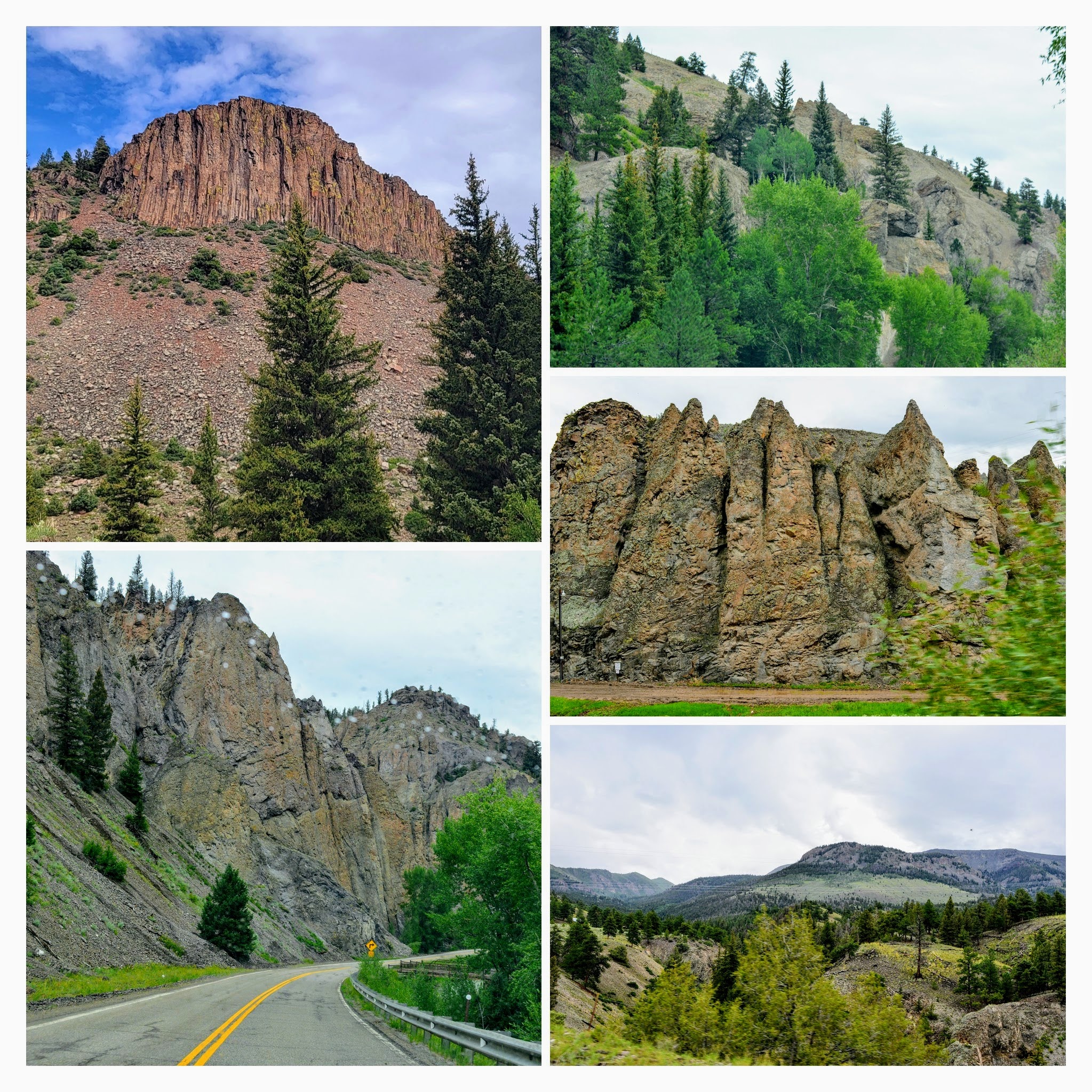


My husband and I marveled at the different shapes of volcanic rock and the erosion that was ongoing over the millenniums.


There were many beautiful castle-like formations of mountainous rock along the way.


Another interesting part of the drive was seeing the Lake Fork of the Gunnison River a 64.7-mile-long (104.1 km) tributary of the Gunnison River in Colorado. The river's source is Sloan Lake near Handies Peak in the San Juan Mountains of Hinsdale County.


Please Click On Photo to Enlarge

As you can read on the placard in the photo collage above the Lake Fork of the Gunnison is one of the many rivers and streams that flow into the Colorado River and travel 1,500 miles to the Sea of Cortez in the Baja of Mexico.


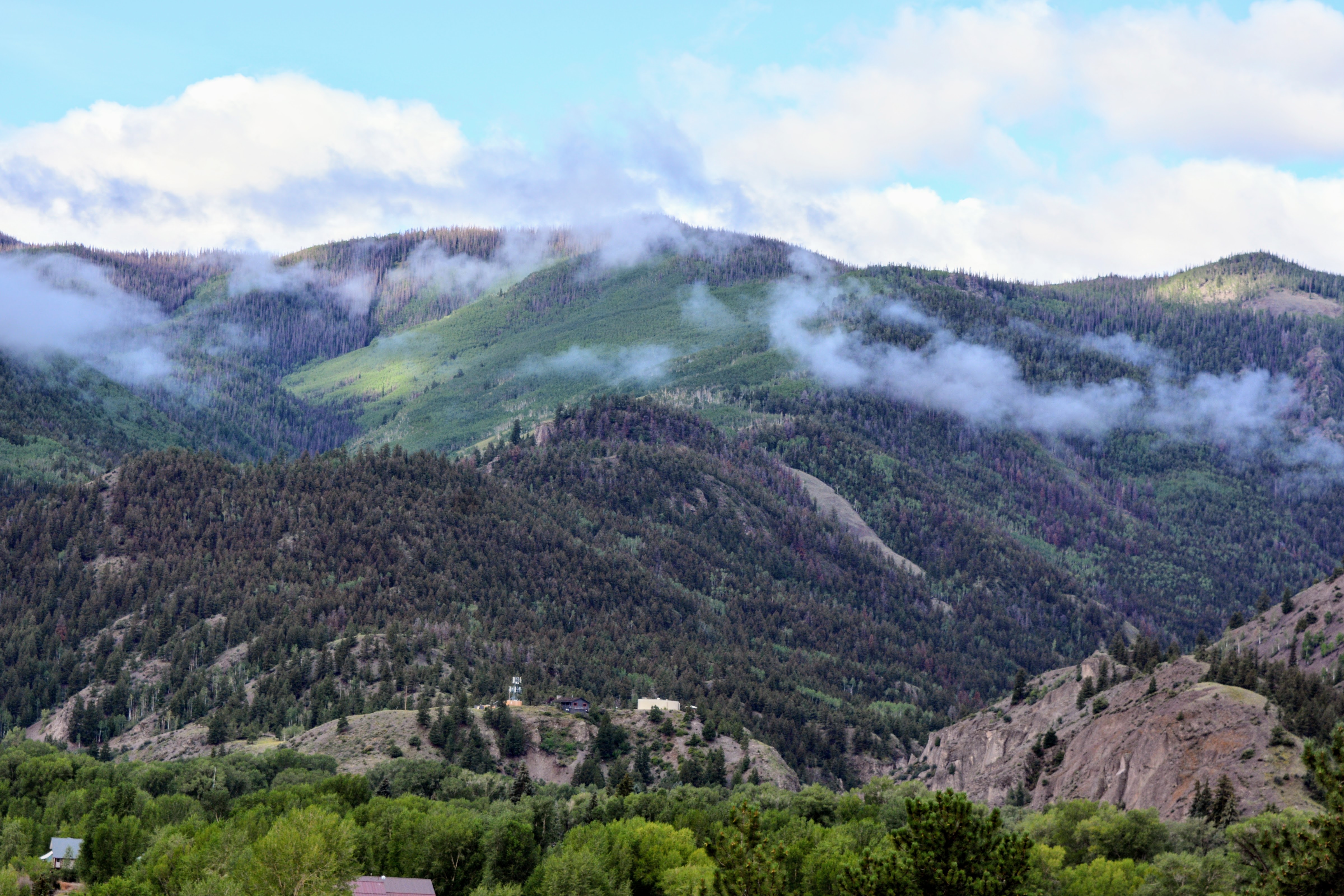
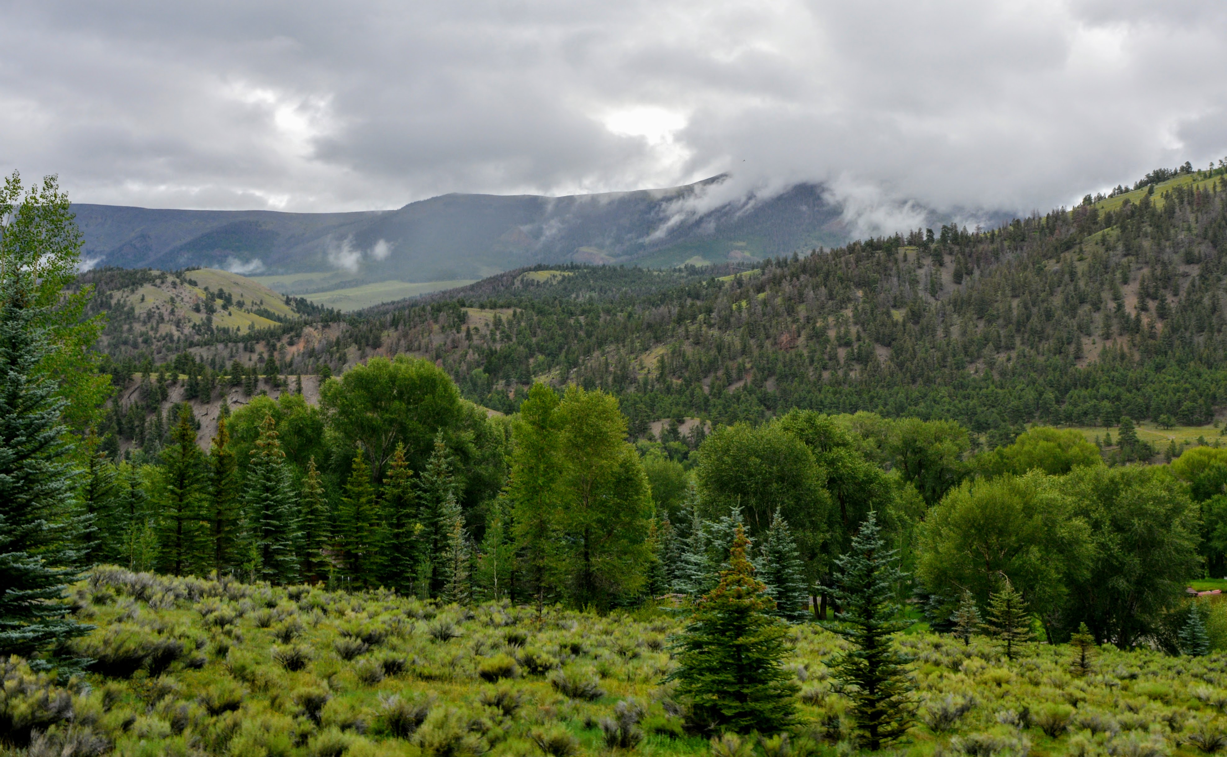
Most of the time as we drove along The Siver Thread Byway we were one of the very few cars on the road.  Much of the land is wilderness, except for an occasional cattle ranch.  


At another stop, we read the ill-fated expedition lead by the guide Alferd Packer in 1874, who was hired to lead five other men from Salt Lake City, Utah, to Los Pinos Agency Gunnison, Colorado.  The Utes warned them that the snow would be treacherous but they kept going.  Sadly they became lost in the San Juan Mountains and only Alfred came out of the mountains in Spring alive, and he was suspiciously well-fed. Was it cannibalism? Read the entire story and see the placard above in detail on this link.


Please Click On the Photos Above to Enlarge


One of my favorite placards on the byway told the story of the "People Of the Shining Mountains"--the Utes.  All of Colorado was once their land and they called the Rockies the Shining Mountains in their native language.


The Silver Thread Scenic and Historic Byway was a beautiful and interesting drive and one of many scenic byways we have driven on in Colorado. To see those other drives click on this link and keep scrolling through 38 other posts!  We hope to drive many more in the future as there are 25 byways in Colorado, and 13 of them have been designated by the U.S. Secretary of Transportation as America's Byways, which gives Colorado more national designations than any other state!

You can also find me on


I'm linking this post to some of the following blog events:

 Mosaic Monday, Blue Monday, Through My Lens Monday, Hearth, and Soul Link Party, You Are the Star Blog Hop, Inspire Me Monday, Home Matters Linky Party,  Good Random Fun, Nature Notes, Grand Social, Travel Photos, Travel Tuesday, Happiness Is Homemade, Create, Bake, Make, Our World Tuesday, Ruby Tuesday, Tuesday's Treasures, Tuesdays With A Twist, Let's Keep In Touch, Wordless Wednesday on a Tuesday,  Party in Your PJ's, Wordless Wednesday, Oh My Heartsie Girl's Wonderful Wednesday, Wednesday My Corner of the World, Wonderful Wednesday, Signs2,  Little Things Thursday, Thankful Thursday, Brians Thankful Thursday, Thursday Encouraging Hearts and Home,  Thursday Thinking Out Loud, Thursday Favorite Things, Friday With Friends, Friendship Fridays, A Morning Cup of Joe, Friday Features Linky Party, Skywatch Friday, Weekend Roundup,  Pink Saturday, Saturday Sparks, Saturday Critters, Sunday on Silverado

Bookmark and Share

Monday, August 30, 2021

Lake City, Colorado


Continuing on our drive on The Silver Thread Scenic and Historic Byway--see my previous posts, here and here. We stopped for the night in Lake City, located in Hinsdale County, Colorado, which is the most remote county in the lower 48 states of the USA!  Nestled in the heart of the San Juan Mountain Range and the Gunnison and Uncompahgre National Forest, just minutes from the spectacular San Cristobal Lake, Lake City is surrounded by 96% public land.  Incorporated in 1875 the town began as a gold and silver mining town.


Activities in Lake City today include hiking, camping, rafting and boating, hunting, fly and ice fishing, horseback riding, and mountain biking over the many spectacular mountain trails.  In winter, activities include cross-country skiing, snowshoeing, snowmobiling, ice climbing, ice skating, and skiing on the town's very own ski hill.


Due to its high elevation at 8,661 feet (2,640 m) and its proximity to some of Colorado’s most rugged and beautiful wilderness, Lake City is a great base for exploring with 4×4 vehicles or OHVs-- off-highway vehicles--on the abundance of trails and roads around Lake City. The most popular adventure for off-road vehicles is the Alpine Loop Scenic Byway. This sixty-five-mile road is generally only passable from June through September of each year. The Alpine Loop Scenic Byway connects the towns of Ouray, Silverton, and Lake City, and the route even features a few authentic ghost towns including Animas Forks. The road navigates two mountain passes that sits 12,000 feet above sea level: Engineer Pass and Cinnamon Pass. Both passes provide unforgettable views of some of Colorado’s famous 14ers including Uncompahgre Peak, Handies Peak, and Sunshine Peak.  


I enjoyed seeing some of the town's rustic cabin homes--my fantasy is to own my own little cabin getaway someday.  Notice all the chopped wood stacked outside one, waiting for the winter months!


Many other homes in town were pretty Victorian style, from mansion size to cottage style.


Lake City has many historic older buildings dating back to the mining era.


There are also many charming stores and restaurants to explore.


The Lake City Town Park in the center of town had a couple of amusing planters hanging in the trees--click on the photo collage to enlarge it to see them better. 

We enjoyed a delicious pizza for dinner at the Silver Slice Pizza Company--there was pepperoni under the folded crust!


We got up early the next morning to continue the final part of our drive on The Silver Thread Scenic and Historic Byway...more scenes from that drive will be in my next post.


We loved visiting Lake City and we promised ourselves that we would have to return for a longer visit one day in the future.

You can also find me on


Bookmark and Share

Monday, August 23, 2021

North Clear Creek Falls in Colorado


Beautiful North Clear Creek Falls in Colorado! 

When I saw that these falls are located just a short detour off The Silver Thread Scenic and Historic Byway--CO-149--I knew that we had to take a drive someday to see these beautiful waterfalls in person.  In early August of this year, we drove down to Southern Colorado and stopped first at the historic mining town of Creede--click here--to see that post.  


When we left Creede, we enjoyed the drive on CO-149--The Silver Thread Scenic Byway-- as we headed towards our next destination of Lake City.  The weather was not cooperating, as it was the rainy season in Colorado, but it did not deter us from enjoying the scenic beauty of the land we passed...the Weminuche Wilderness.


Please click on to enlarge the photo

Information from the  Forest Service Department website:

"At three quarters the size of Rhode Island, the Weminuche Wilderness is the largest Wilderness area in Colorado at 499,771 acres. It is part of the National Wilderness Preservation System, established by the Wilderness Act of 1964 to "secure for the American people of present and future generations the benefits of an enduring resource of wilderness." The Weminuche was designated by Congress in 1975 and expanded by the Colorado Wilderness Acts of 1980 and 1993.

The Weminuche spans the Continental Divide, North America's geological backbone, with its headwaters diverted to both the Pacific and Atlantic oceans. Eolus, Sunlight, and Windom peaks rise above 14,000 feet, while many others reach above 13,000 feet. With an average elevation of 10,000 feet above sea level, the Weminuche is rugged country, but its ecosystems are fragile.

The Weminuche protects the headwaters of both the Rio Grande River and the San Juan River (which then runs into the Colorado River) providing clear drinking water to millions of people."


The North Clear Creek Falls overlook facility is situated as a stop on the Silverthread Scenic Byway right along State Hiway 149.  The 100 foot ( 0.48 M) long gushing waterfall is directly fed by the meltwaters of the high altitude mountains of the San Juan Mountain Range near Slumguillion Pass around 11,500 feet (3505.2 M), and Spring Creek Pass at around 10,500 feet (3200.4 M) elevation. 


The video above of the waterfall can also be seen on YouTube on this link.  We stood for quite awhile watching the majestic waterfall while we stood in the rain.  What a thrilling sight! 


Please click on to enlarge the photo

One of the informational placards at the waterfall viewing platform which explains the geologic formations of this area caused by volcanos 27 million years ago.


We hiked one of the trails to see more of the unusual volcani terrain, with views of the winding river far below.  It felt like we were in a  very otherworldly place!


Traveling back on The Silver Thread Scenic and Historic Byway--CO-149--we passed a few cattle ranches and then reached Slumgullion Pass. Located just outside of Lake City, Colorado, Slumgullion Pass is an ultra-high mountain pass with an elevation of 11,530 ft (3,514 m). We learned that because this pass has grades on the north side of the pass up to 9%, that State Highway 149 is the steepest, maintained paved road in Colorado! Slumgullion Pass is named for the nearby Slumgullion Earthflow, a gigantic landslide whose yellowish soil reminded early settlers and miners of slumgullion stew.


We stopped to see the view from Windy Point Overlook. The overlook offers a superb view of the majestic mountain peaks surrounding Lake City. Colorado has 58 mountain peaks higher than 14,000 feet (4267.2), and five of them are in the San Jaun Mountain Range near Lake City.  Next post I'll continue on to Lake City--the only town in all of Hinsdale County, Colorado.


Bookmark and Share

Monday, August 9, 2021

A Visit to Creede, Colorado


My husband and I decided that even though we were having an actual "monsoon season" of rain in Colorado this August we needed to go on a little "getaway" drive somewhere in our state.  The air quality has been terrible lately in the Denver area because of all the western wildfire smoke blowing east our way combined with ground-level ozone from the unusually high summer temperatures and fossil fuel use.  We were thankful that we bought a powerful portable air purifier for our house this year as it has been running constantly, but we missed sitting outside or taking hikes.

We wanted to get out into the great outdoors in an area that is full of wilderness and not much population, so we decided to take a drive on The Silver Thread Scenic and Historic Byway in SW Colorado--CO 149.   We heard so much about this scenic byway that runs between the old mining towns of Creede and Lake City all the way to Gunnison and we were excited to drive on it!


As we drove on US Route 285 to CO 121 to CO 149 we passed misty morning fog, gigantic clouds, and many roadside wild sunflowers...


...and passed verdant green valleys and beautiful red rock canyons...


...until we finally reached the town of Creede.

Creede began as a booming silver mining town, founded in 1890 after Nicholas Creede discovered silver at the Holy Moses Mine. You can read more about the interesting history of Creede on this link. Located in the heart of Mineral County, Creede now provides access to some of Colorado’s most popular backcountry regions: the Weminuche and La Garita Wilderness Areas, and the San Juan and Rio Grande National Forests.  It is an area that has some of the state’s finest fishing streams, and backcountry trails and is surrounded by towering mountain peaks.


There is lots of true "old west" charm in Creede as you can see from the photos above. We had planned to drive the seventeen-mile "Bachelor Loop" historic road which passes some of the old mine locations from the 1890s and abandoned ghost towns that once rivaled Creede in size. The road weaves its way up through the canyon north of Creede climbing under the ragged cliff sides and is a dirt road that requires a four-wheel drive.  Unfortunately, it began to rain heavily and we decided against chancing that drive. We will have to return someday in the future to do it.


Founded in 1966, the acclaimed Ruth Humphrey Brown Creede Repertory Theatre (CRT) is located on Main Street in Creede.  May through September this award-winning company produces big city quality productions in this spectacular location. Each season, CRT produces 7-10 plays in rotating repertory, hosts numerous musical events and concerts, develops new works through the Headwaters New Play Program, and offers nationally recognized educational programming. It has been called "One of 10 great places to see the lights way off-Broadway." by USA Today.


Also along part of Main Street in Creede was a church that had this inspirational sign on view.  I later found the origin of this "Love Your Neighbor" banner which you can see (and order one) on this link.


More views of Main Street in Creede.


We were going to continue on our drive on the Silver Thread Scenic Byway but first, we had lunch at Kip's Grill.  I had the special--an open-faced cheeseburger smothered in green chile---so delicious!


On our way out of town, we passed by an old mine structure...

Please click on the photo to enlarge to read the placards


It was not a silver mine but a Clay Mine. During the 1930s and 1940s, the site was mined for bentonite clay for a variety of uses including cosmetic makeup, salt water taffy, and munitions. The site includes the remains of a closed mine shaft, an ore bin, a tailings pile, and two historic service roads. It is believed that the mine was leased and built in the late 1920s and operated from 1938-1945 by the Birdsey family of Creede, Colorado.


We were back on the 117-mile Silver Thread Scenic and Historic Byway.

For the next few blog posts, I'll show more of the amazing sights we saw along the way!

PS: My "deer" friends --see prior post--have not visited us this week.  Most likely it is because our temperatures have been more normal in the lower 80s and they have not been seeking shade. I thank you for all the wonderful name suggestions for them--I'm going to try them out the next time I see them.

You can also find me on

Bookmark and Share