Showing posts with label Share Your Cup. Show all posts

Sunday, November 4, 2018

The Curecanti National Recreation Area and Blue Mesa Reservoir in Colorado


When my husband and I left Crested Butte on our visit at the end of September, (click here and here to read those posts) to drive to the Back Canyon of the Gunnison National Park (click here to read that post), we had to drive on US Highway 50 through the Curecanti National Recreation Area and over the Blue Mesa ReservoirThis area in Colorado has an unusual natural beauty.
(All photos will enlarge if clicked on)


The Curecanti National Recreational Area is a series of three reservoirs along the Gunnison River. The reservoirs are a destination for water-based recreation high in the Rocky Mountains. Best known for salmon and trout fishing, Curecanti also offers opportunities for hiking, boating, camping, and bird watching.  A National Park Service PDF shows the size and layout of the area--click here to view.


Seen above are the Dillon Pinnacles in the Curecanti National Recreation Area, located above the Lake Fork section of the Blue Mesa Reservoir near Gunnison, Colorado. They are high craggy rock formations, made of eroded West Elk Breccia, a composite rock spewed from the volcanic West Elk Mountains 30 million years ago.


It is impossible to pass the pinnacles without being impressed at their sharply eroded appearance.


There is a 2.8-mile trail that leads through the area's high desert landscape of sagebrush and stubby alpine trees to the base of the Dillon Pinnacles. The trail begins at 7,526 feet altitude. with a total elevation gain of 741 feet.


The Blue Mesa Reservoir in the Curecanti National Recreation Area is the largest body of water in Colorado, spanning 20 miles and boasting 96 miles of shoreline. It is also the largest Kokanee salmon fishery in the U.S. and receives a copious stocking of brown, rainbow, and mackinaw trout. Unfortunately, recent years of drought and low snowfall have made the reservoirs levels reduce to historic low levels. As of this writing, it is only at 39% capacity.  I am hoping that this winter will bring back normal levels of snowfall to rectify this problem. Colorado rivers supply water to many western states.

A view of the Blue Mesa Dam, completed in 1966, which is situated at a narrows in the river valley where the Gunnison River enters the upper reaches of the Black Canyon of the Gunnison.  


Driving further on I could see the Gunnison River flowing into the Black Canyon of the Gunnison, an area of deep erosion created by the river flowing into this area over millions of years.  To see more of the Gunnison River in the Black Canyon go to my blog post on this link.


After leaving the Black Canyon of the Gunnison National Park we drove again on US Highway 50 to return to Crested Butte.


 In this part of the drive, we passed cattle ranches...


...and just a small bit of autumn color among the mainly sagebrush-covered hills.


We then again passed by the reservoirs of the Curecanti National Recreation Area. You can take a park ranger-led boat ride into the Black Canyon of the Gunnison during a leisurely 1½ hour boat tour on the Morrow Point Reservoir during the months of June till mid-September.


I couldn't help but laugh when we drove past this sign for the "Bay of Chickens" in the Curecanti National Recreation Area. Curiosity about its name leads me to many online searches without success, except that I learned it has a facebook page and that it is a pleasant beach stop along the Blue Mesa with a picnic and swimming area, but has no chickens.


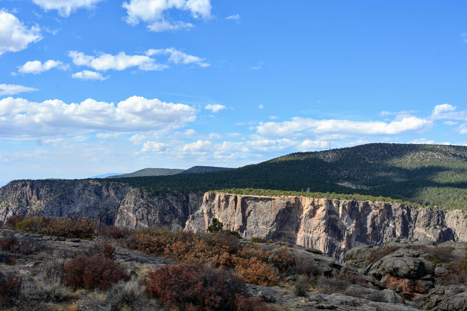
Some more views of the picturesque Curecanti National Recreation Area and the Blue Mesa.


In about two hours we were back in the Crested Butte area.....


 ...and as you can see from this photo this is the way I take many of my travel photos from the road--pointing my camera at the views outside our car window as we drive along.


It seems to work!

Mount Crested Butte

Soon after leaving Crested Butte and returning to the Denver area of Colorado, my husband and I flew to New York to attend a very special anniversary party for my older brother and sister-in-law, and also to enjoy a few days at the very eastern end of Long Island in Montauk. More about that trip on my next post!


You can also find me on 


I'm linking this post to the following blog events:

Amaze Me MondayMosaic MondayAll SeasonsBlue Monday,  Through My Lens MondayInspiration Monday, Blogging GrandmothersHearth, and Soul Link PartyYou Are the Star Blog HopGood Random FunNature NotesGrand SocialTravel Photos, Photo Tunes, Happiness Is HomemadeTuesday TreasuresPictorial TuesdayOur World TuesdayRuby TuesdayTuesdays With A TwistParty in Your PJ'sWordless WednesdayNanahood WWOh My Heartsie Girl's Wonderful WednesdayOutdoor Wednesday, Words On WednesdayWhimsical WednesdayYour Whims WednesdayWednesday Around the WorldWonderful Wednesday,  Share Your CupLittle Things Thursday, A Blogging Good TimeThankful ThursdayThursday Favorite ThingsThursday Traffic Jam Weekend LinkyPretty Pintastic PartyFriendship FridaysFriday Photo JournalSkywatch FridaySweet Inspiration, Pink SaturdaySaturday CrittersOver the MoonHappiness Is HomemadeWandering Camera (monthly-last Thursday of the month)

Bookmark and Share

Monday, October 29, 2018

The Black Canyon of the Gunnison National Park


While my husband and I were visiting Crested Butte, Colorado, at the end of September -- click here, here and here, to see those posts, we decided to take a side trip to The Black Canyon of the Gunnison National Park.  This was going to be our second visit to this unique national park. We visited it in 2016 in late November--click here to read my post about that visit-- when we celebrated Thanksgiving in the towns of Telluride, Ouray, and Ridgway in SW Colorado. At that visit, the only section of the national park that was open was the area around the visitor center.  The rest of the road and trails were closed due to snow and ice. We vowed to come back someday to see the rest of the park and were happy to be able to visit it again at this time. (All photos will enlarge when clicked on)


Driving south-west from Crested Butte on US 50 to CO 347 it took us an hour and 45 minutes to reach the main entrance of the park. Along the way, I had my first glimpse of the Gunnison River that flows through the canyon.


The first stop in the park, Tomichi Point, shows the impressive, steep, deep and narrow canyon. The park protects the deepest 14 miles of the Black Canyon gorge, about 75 miles upstream from the Gunnison's junction with the Colorado River.


A placard at this stop shows the eleven more viewpoints that are ahead in the park a total 6-mile drive.


The first viewing platform in the distance, as seen from the park's visitor center window. At the visitor center, we enjoyed seeing exhibits and a movie about the Black Canyon of the Gunnison and the history of its explorers and the attempts to navigate the Gunnison River and build a railroad at the bottom. You can read more about the canyon's history on this link.


At each of the eleven stops, there is a trail leading to a viewing platform that allows for safe spectacular views down into the canyon.


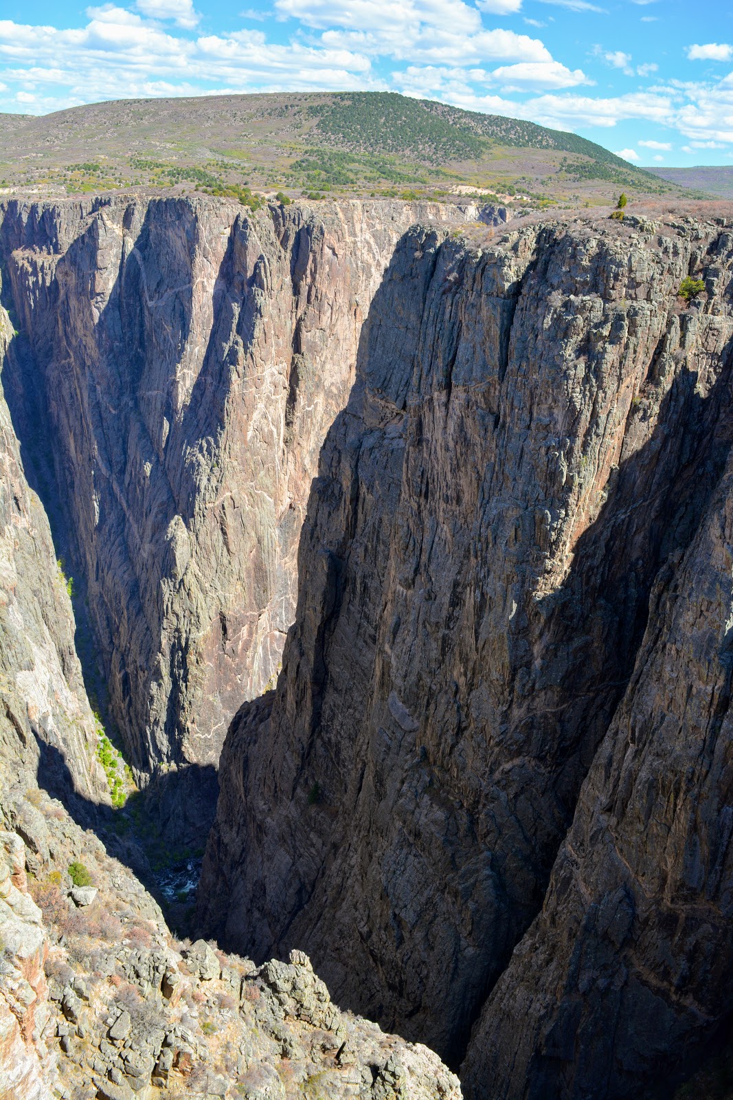
Black Canyon of the Gunnison exposes you to some of the steepest cliffs, oldest rock, and craggiest spires in North America. 


With two million years to work, the Gunnison River, along with the forces of weathering, has sculpted this vertical wilderness of rock, water, and sky.


The Black Canyon is so named because its steepness makes it difficult for sunlight to penetrate into its depths. As a result, the canyon is often shrouded in shadow, causing the rocky walls to appear black. At its narrowest point, the canyon is only 40 ft (12 m) wide at the river. 


The canyon has some of the world’s oldest exposed rock — Precambrian or “basement” rock that is nearly 2 billion years old!


My husband peering over the side at one of the viewpoints.

Each stop along the way is named and has the length of the trail leading to the viewing platform. 


All of the stops are along the south rim of the canyon, There is no bridge crossing over the canyon and road access on the north side is very limited.


The Painted Wall section of the Black Canyon of the Gunnison is the tallest sheer cliff in Colorado at 2,250 feet (690 m). Lighter-colored pegmatite dikes are clearly visible in the rock walls.


The Gunnison River drops at a far steeper pace than the Colorado River in the Grand Canyon. At its steepest part, the river drops 240 feet per mile.

The elevation of the top of the rim of the canyon is almost 8,000 feet, and the canyon descends 2,000 to 2,722 feet above the swift and turbulent Gunnison River below. That depth is near twice the height of the Empire State Building!


You can see mountain ranges in the distance from portions of the rim.


There are unmaintained hiking trails on the north and south rims of the canyon, which take about two hours to hike down, and four hours to hike back up. 

All inner canyon descents are strenuous and require Class 3 climbing and basic route finding skills, plus an official permit. Most visitors to the park view the canyon by the various scenic overlooks.

On this visit, we were able to drive down to the Gunnison River by taking the East Portal Road inside the park. This provides access into Curecanti National Recreation Area where camping, picnicking and fishing are available.


The road is extremely steep --16% grades--with hairpin curves. 


Down, down, down, we descended...


 ...until we reached the banks of the Gunnison River.


Here we were able to park and walk along a portion of the river...


..and admire the views looking up! 

There are trails to hike on the bottom of the canyon, but they require permits and more time than we had.


We spent almost the entire day at the rim of the Black Canyon of the Gunnison, driving and then hiking to all of its magnificent viewpoints...


..and knowing we had an almost two hours drive back to Crested Butte, we left the area to return to the town for a late dinner. We were so happy that we were finally able to see the entire national park from the south rim and the bottom up. It certainly was one of the most unique parks we have ever visited!

On my next post, I'll show you the Blue Mesa and the very unusual topography of the Curecanti National Recreation Area that we passed along the way.


You can also find me on 


I'm linking this post to the following blog events:

Amaze Me MondayMosaic MondayAll SeasonsBlue Monday,  Through My Lens MondayInspiration Monday, Blogging GrandmothersHearth and Soul Link PartyYou Are the Star Blog HopGood Random FunNature NotesGrand SocialTravel Photos, Photo Tunes, Happiness Is HomemadeTuesday TreasuresPictorial TuesdayOur World TuesdayRuby TuesdayTuesdays With A TwistParty in Your PJ'sWordless WednesdayNanahood WWOh My Heartsie Girl's Wonderful WednesdayOutdoor Wednesday, Words On WednesdayWhimsical WednesdayYour Whims WednesdayWednesday Around the WorldWonderful Wednesday,  Share Your CupLittle Things Thursday, A Blogging Good TimeThankful ThursdayThursday Favorite ThingsThursday Traffic Jam Weekend LinkyPretty Pintastic PartyFriendship FridaysFriday Photo JournalSkywatch FridaySweet Inspiration, Pink SaturdaySaturday CrittersOver the MoonHappiness Is Homemade, Wandering Camera (monthly-last Thursday of the month)


Bookmark and Share