The distant Rocky Mountain peaks in South Park were surrounded by misty fog in the early morning sun, and patches of snow could still be seen in some of the shady spots on the vast grasslands.

As we drove west we could see the grass beginning to become green again with the warmer spring weather.

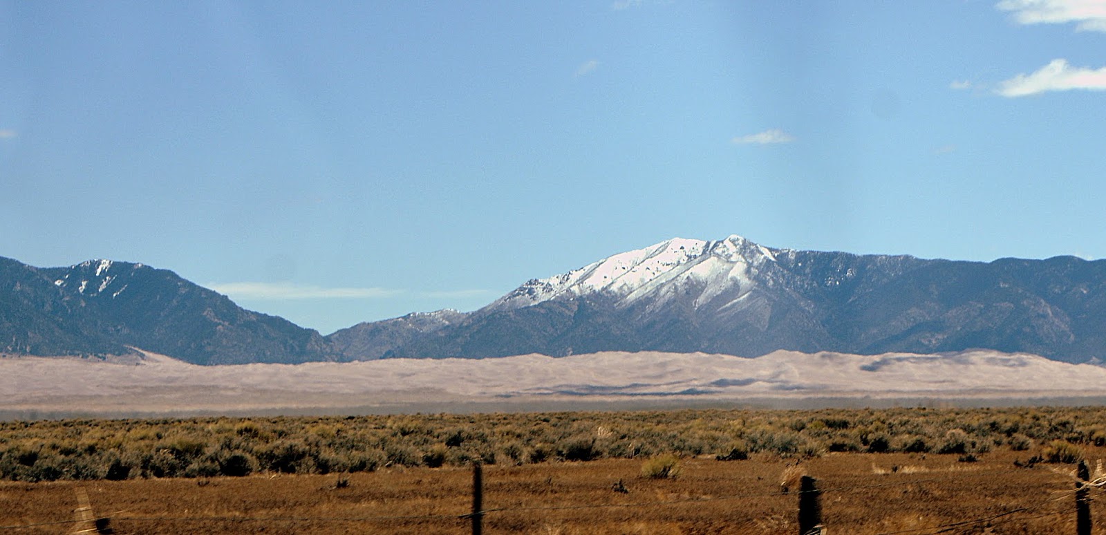
As always, the sight of the Collegiate Peaks of the Sawatch Range of the Rocky Mountains, near the town of Buena Vista, is a magnificent sight to see!

Soon, off into the distance, we can see the long sand dune formations at the base of the mountains. These sand dunes began forming over 400,000 thousand years ago and are the highest sand dunes in North America.

At this distance, they seem small compared to the 13,000-foot Sangre de Cristo mountains looming above them, but the dunes reach up to 750 feet in height!

The dunes formation begins in the San Luis Valley, which is a broad plain between the San Juan Mountains on the west (seen in the photo above) and the Sangre de Cristo Mountains on the east. Streams and creeks flowing out of the San Juan Mountains over the millennia carried gravel and sand into shallow lakes in the San Luis Valley. During drought periods, these lakes dried, releasing sand particles into the wind.

Strong prevailing southwesterly winds carry the grains of sand toward the Sangre de Cristo Mountains and pile them up against the foothills, resulting in the sand dune formations covering more than 30 square miles. As you can see in the photo above, we could actually notice the sand blowing east off the valley floor.

We traveled south on CO-17 and then east on lane 6 N and CO-150 North towards...


After seeing the dunes in the distance for a long time while we drove, it was thrilling to finally be approaching them.

The full measure of their height and length was amazing.

We stopped at the park's visitors center where we watched a 20-minute movie about the sand dunes formation and the park's history.

There was a beautiful panorama of the dunes from the visitor's center back porch...

Click to enlarge
..and many interesting placards to read about the history of the area and the preservation efforts.

The dunes and surrounding area were designated a National Monument in 1932. In the year 2000, United States President Bill Clinton signed the Great Sand Dunes National Park and Preserve Act. The federal government purchased 97,000 acres of the Baca Ranch which tripled the size of the park and preserved the land and water drainage for future generations to enjoy.

One of the fascinating features of the park is the seasonal Medano Creek that runs in front of the dunes.

Medano Creek's depth and duration are directly linked to the snowpack in the mountains above the dunes.


The fantastic thing is that Medano Creek only appears in spring and by summer disappears below the sand and is no longer visible. I'm glad we were able to see it!


The Great Sand Dunes National Park and Preserve--a wonder of the world and a Colorado treasure!


At the time we visited the creek was flowing in a steady stream...

...but it was still shallow enough in places to cross while still wearing shoes if one was careful.

It wound around in ripples...

...shallow...

...to deep!

The creek extended far in the distance...

...and was a barrier to cross before walking towards the dunes.
The fantastic thing is that Medano Creek only appears in spring and by summer disappears below the sand and is no longer visible. I'm glad we were able to see it!

Imagine playing sand volleyball at the base of a snow-capped mountain in Colorado?

Come back next post, to see part two, and I'll show you what it is like to walk up the dunes!