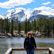
In autumn of 2019, my husband and I took a scenic drive in Colorado into Clear Creek Canyon, between Buena Vista and Leadville, Colorado to visit the silver mine ghost towns of Vicksburg and Winfield.


There were many beautiful mountain views along the drive.

In about nine miles we reached the town of Vicksburg.
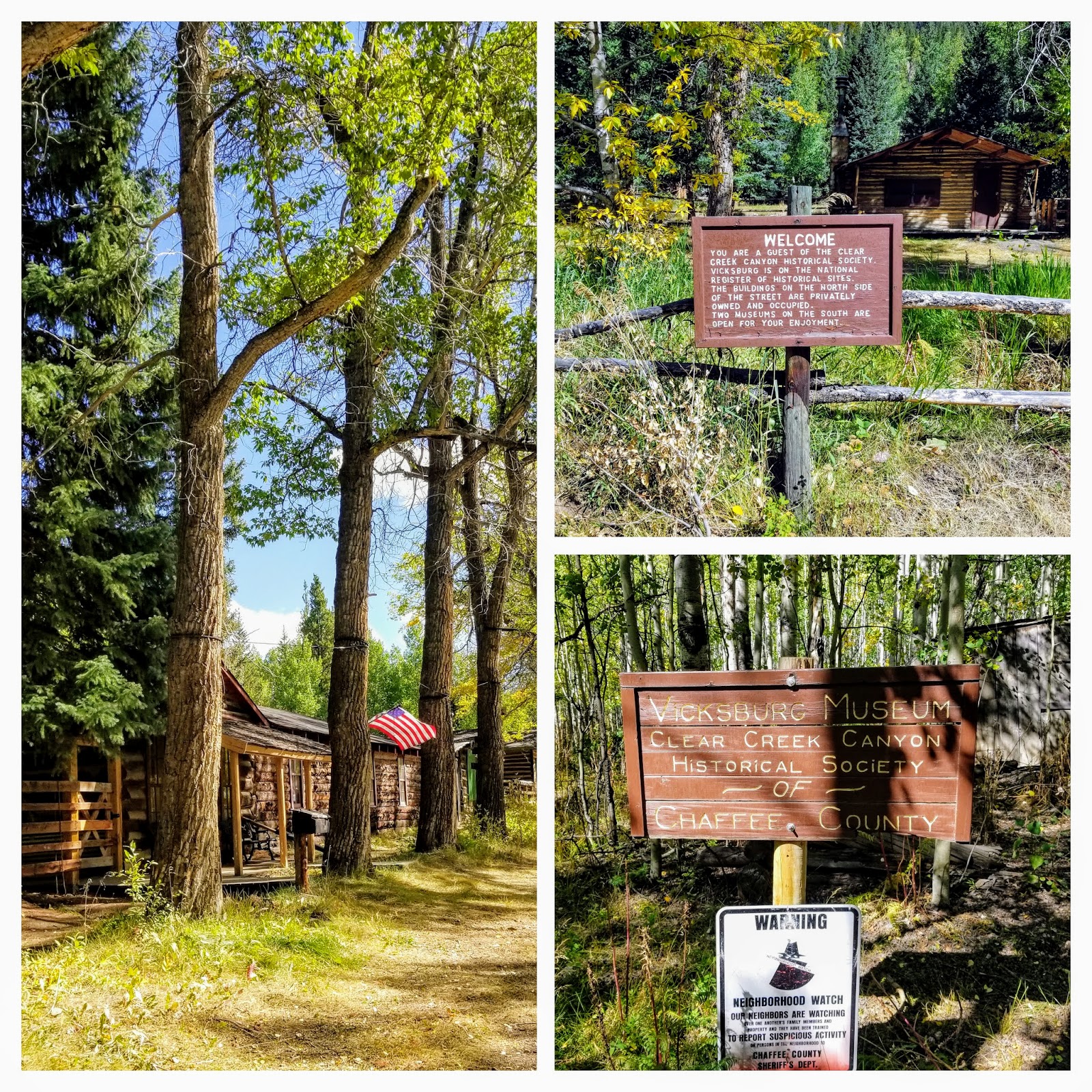
Vicksburg was founded in 1867 after prospectors from Leadville, Colorado, who were camping out in the Clear Creek Canyon lost their burros. The burros had wandered down the creek and when the miners found their pack animals, they discovered gold in the creek bed as well. More than gold, however, the surrounding area was rich in silver and copper. Early miners brought in "Balm of Gilead" (balsam poplar) trees on the backs of burros and planted them to line the main street of Vicksburg, where they still remain


Quite a few interesting vintage mining implements and machines were on display around the cabins.

After visiting Vicksburg we continued on our drive...


Between Vickburg and Winfield is a small assortment of cabins for rent where more silver-boom towns once stood -- the towns of Rockdale and Silverdale. There are rustic cabins available for daily rent here. We spoke with a forest ranger who was sweeping out a cabin and she told us fishermen, hikers, mountain climbers, etc, rent the cabins all summer.

Continuing on for about five miles we reached the end of the county road and the town of Winfield.

Winfield was founded in 1861 with the first recorded silver prospecting done in 1867. Located on 120 acres at the junction of the north and south forks of Clear Creek, the town made lots of 50×100 free to anyone who desired to build there. In its prime, around 1890, some 1500 people lived in town. The silver market crash and depression in 1893 halted the mining activity in Clear Creek Canyon. There was a resumption in the early 1900s and the last ore was hauled out of the canyon by two-horse wagon in 1918.

Please click on photo to enlarge it
The history of the town is displayed in an open book in the Winfield schoolhouse window.

Two of the buildings are open as a museum during the summer, hosted by members of the Clear Creek Historical Society, while the rest are now privately owned and occupied seasonally.

There were quite a few trailheads located at the end of Winfield. The Winfield Cemetery was a quarter mile down a narrow winding road that would require high clearance 4WD. Although 26 people are buried there, only two stone marker stones for children remained. In 2016, a descendant of one of the men buried there worked with the historical society to clean up the cemetery and place wooden crosses on the graves. If you would like to see a local Denver news video about that effort and the story click here.

Can you imagine living such a rugged life at 10,000 feet, all because of hopes and dreams of finding riches in the surrounding mountains? The gold and the silver rush is the pioneer story of the state of Colorado and became the "boom and bust" of many a town. To see more Colorado mining ghost towns visit my post on the Independence Pass Ghost Town--click here--and Saint Elmo Ghost Town--click here.
You can also find me on
I'm linking this post to the following blog events:
Mosaic Monday, All Seasons, Blue Monday, Through My Lens Monday, Little Cottage Link Party,
Hearth, and Soul Link Party, You Are the Star Blog Hop, Inspire Me Monday, Good Random Fun, Nature Notes, Grand Social, Travel Photos, Photo Tunes, Happiness Is Homemade, Over the Moon, Our World Tuesday, Ruby Tuesday, Tuesday Turn About. Tuesdays With A Twist, Let's Keep In Touch, Wordless Wednesday on a Tuesday, Say Cheese!, Party in Your PJ's, Wordless Wednesday, Nanahood WW, Oh My Heartsie Girl's Wonderful Wednesday, Your Whims Wednesday, Worldless Wednesday My Corner of the World, Wonderful Wednesday, Little Things Thursday, Thankful Thursday, Thursday Encouraging Hearts and Home, Full Plate Thursday, Friendship Fridays, Friday Features Linky Party, Skywatch Friday, Pink Saturday, Saturday Critters,
Grammys Grid-Month Long Linky PartyHearth, and Soul Link Party, You Are the Star Blog Hop, Inspire Me Monday, Good Random Fun, Nature Notes, Grand Social, Travel Photos, Photo Tunes, Happiness Is Homemade, Over the Moon, Our World Tuesday, Ruby Tuesday, Tuesday Turn About. Tuesdays With A Twist, Let's Keep In Touch, Wordless Wednesday on a Tuesday, Say Cheese!, Party in Your PJ's, Wordless Wednesday, Nanahood WW, Oh My Heartsie Girl's Wonderful Wednesday, Your Whims Wednesday, Worldless Wednesday My Corner of the World, Wonderful Wednesday, Little Things Thursday, Thankful Thursday, Thursday Encouraging Hearts and Home, Full Plate Thursday, Friendship Fridays, Friday Features Linky Party, Skywatch Friday, Pink Saturday, Saturday Critters,