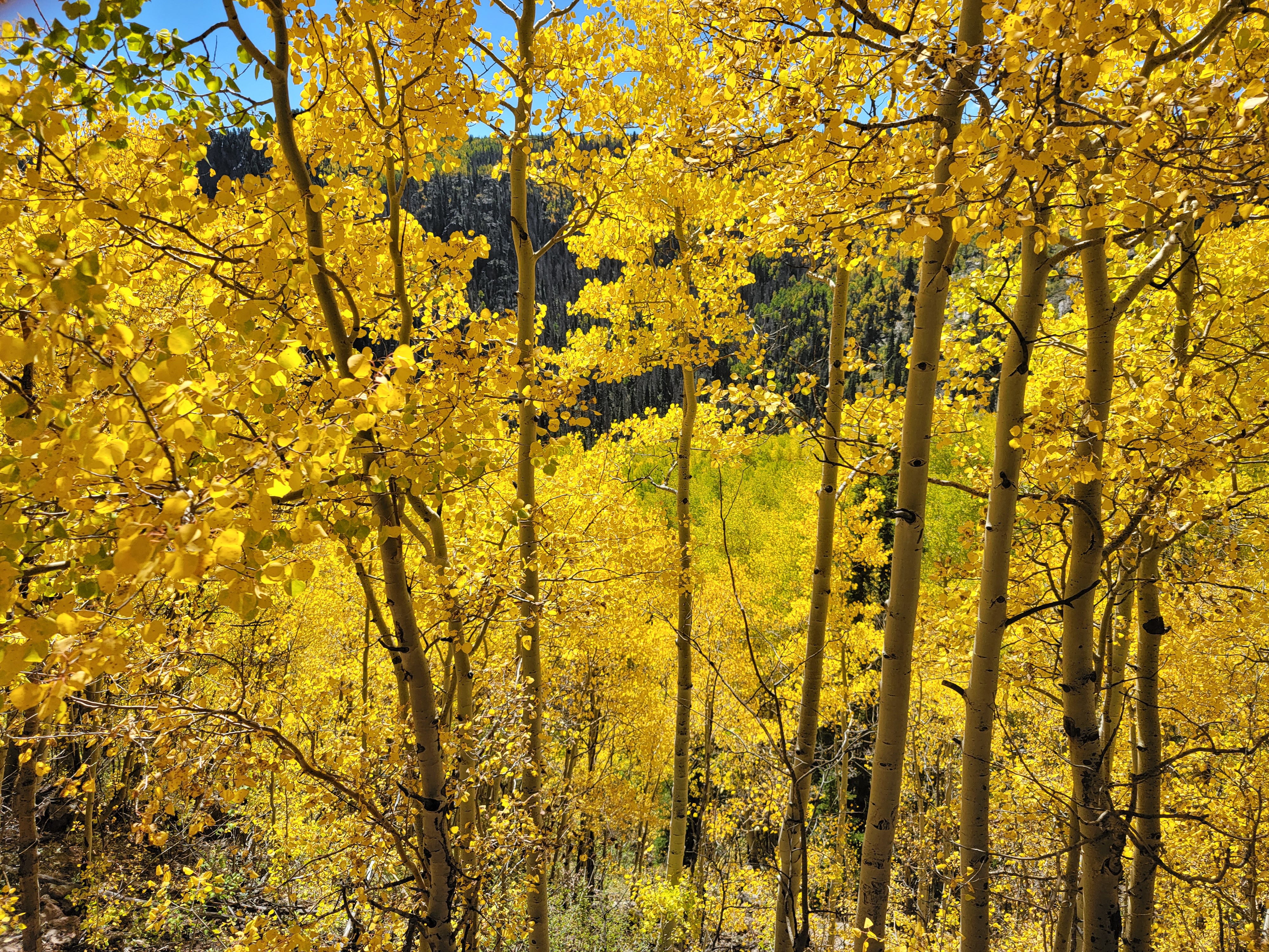
Last week my husband and I decided to take a quick trip to Southern Colorado to see some iconic sights as an early anniversary celebration. We usually like to wait until early October to do a long drive as fall arrives early in Colorado and the aspens begin to turn gold. Autumn is my favorite season as I love the cooler temperatures and beautiful colors of nature.
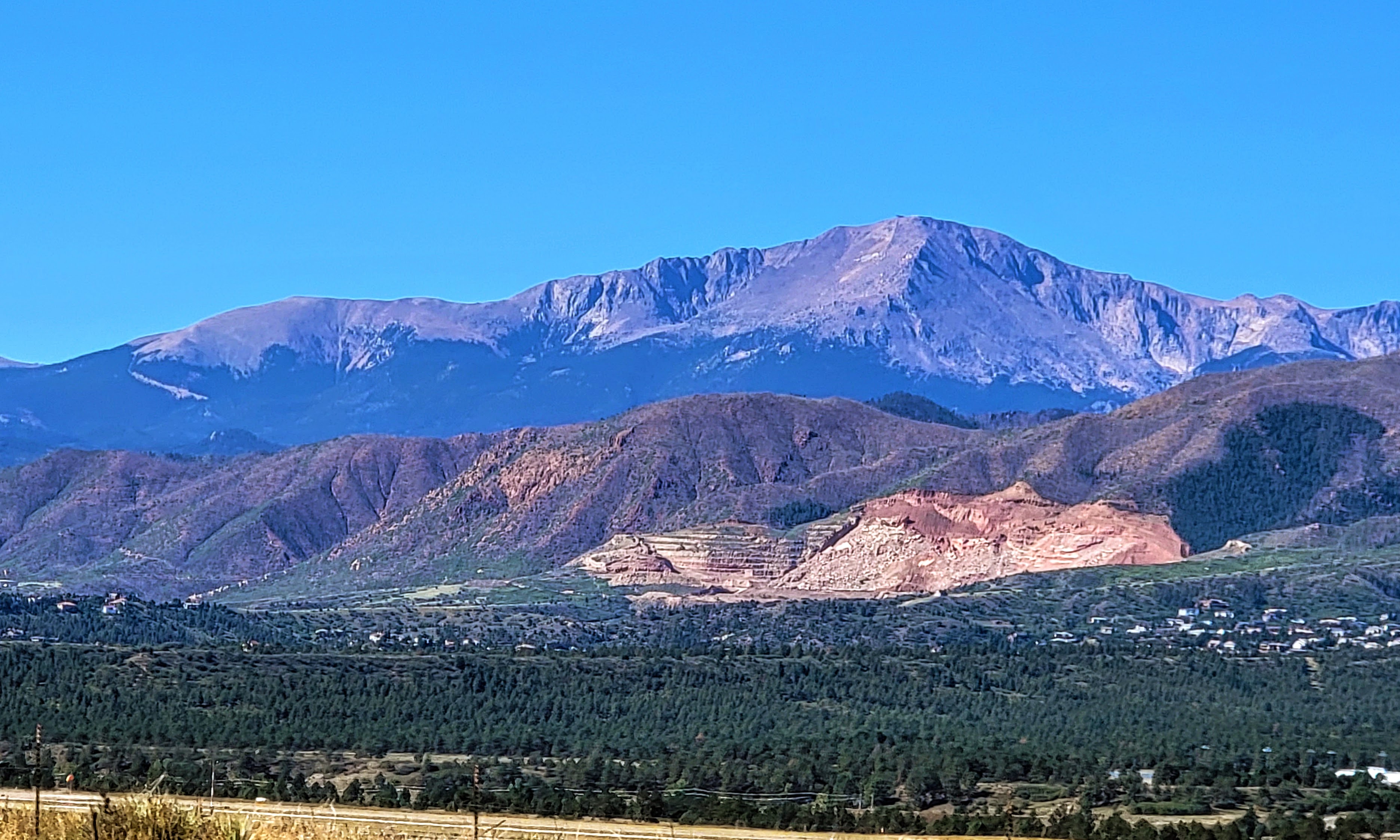
We drove past Pikes Peak also known as "America's Mountain"
Pikes Peak is a 14,115-ft. pink granite peak featuring hiking trails with stunning views, climbing & campgrounds. You can read a post about our first drive up to the mountain's summit on this link, and our last trip in 2021 when many changes were taking place at the summit--click here--to see that post.

As we continued driving south we finally reached the San Luis Valley which is rimmed by the Sangre de Cristo Mountain Range. A view of Mount Blanca is above, It is the fourth highest summit of the Rocky Mountains in Colorado, and at 14,351 feet (4,374 m) it is the highest summit of the Sangre de Cristo Range.
I blogged about this beautiful peak in a prior post, in which I also explained why Navajo Native Americans consider the peak sacred--click here--to read that post


This area is just as impressive during the winter months when the falls freeze into an enormous column of ice! Our daughter did this hike in early spring when the falls were frozen yet still could be heard running underneath the thick ice.


The dunes cover an area of about 30 sq mi (78 km) and are estimated to contain over 1.2 cubic miles (5 billion cubic meters) of sand.


We could see some colorful aspens on some of the mountains' higher elevations.

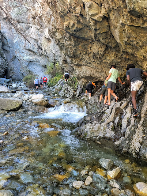
We visited this part of Colorado a few years ago but did not have a chance on that trip to hike up to see Zapata Falls, so this time we wanted to accomplish that task. We soon approached the Zapata Falls Recreation Area.
Zapata Falls is a waterfall located near the base of the Sangre de Cristo Mountains on Bureau of Land Management land adjacent to Rio Grande National Forest and south of Great Sand Dunes National Park.

As we drove up the road leading to the parking lot beyond the Zapata Falls Campground area we had a wonderful view of a part of the San Luis Valley.
The San Luis Valley is over 50 miles wide and over 100 miles long, at 8,192 square feet (21,000 km) with an average elevation of 7,664 feet (2,336 m) above sea level. It is larger than some American states!

Please click on the collage above twice to enlarge it fully for an easy view of the placard information at the trailhead.
We parked our car and began to hike, passing the informational signs above. They explained that the hike ahead would be a half mile each way, and have a 400-foot elevation to 9,400 feet. They also explain how the area is a moraine formed by a glacier two million years ago.

Please click on the collage to enlarge it for a full-view
The hike up was very rocky and soon followed alongside the South Zapata Creek

At certain points, the cold creek had to be crossed over to continue the hike.
As you can see and hear in my video above the creek water was running fast and loud!

It was slow going for us as we were trying to be very careful not to fall on the slippery rocks. I did fall once but was able to recover quickly without getting too wet.

We saw younger and more agile hikers taking different approaches along the rock walls of the slot canyon. At one point my husband thought we should turn back, but I was determined that since we came this far we should keep going.
We were glad we did keep going!
As you can see from the video above the thunderous 25-foot-long waterfall was pounding down inside a slot canyon. Be sure to look all the way to the top. We felt we could not go in any further to get a full view as the water was cold and getting deeper, so I leaned in as far as possible to get this video on my phone.


It was exciting for us to have made it this far!

Considering that it was almost October the falls were still fairly full. I imagine in late spring they would be even more full and really roaring with snow melt!

After recrossing the creek a few times we began the rocky half-mile walk back down to our car

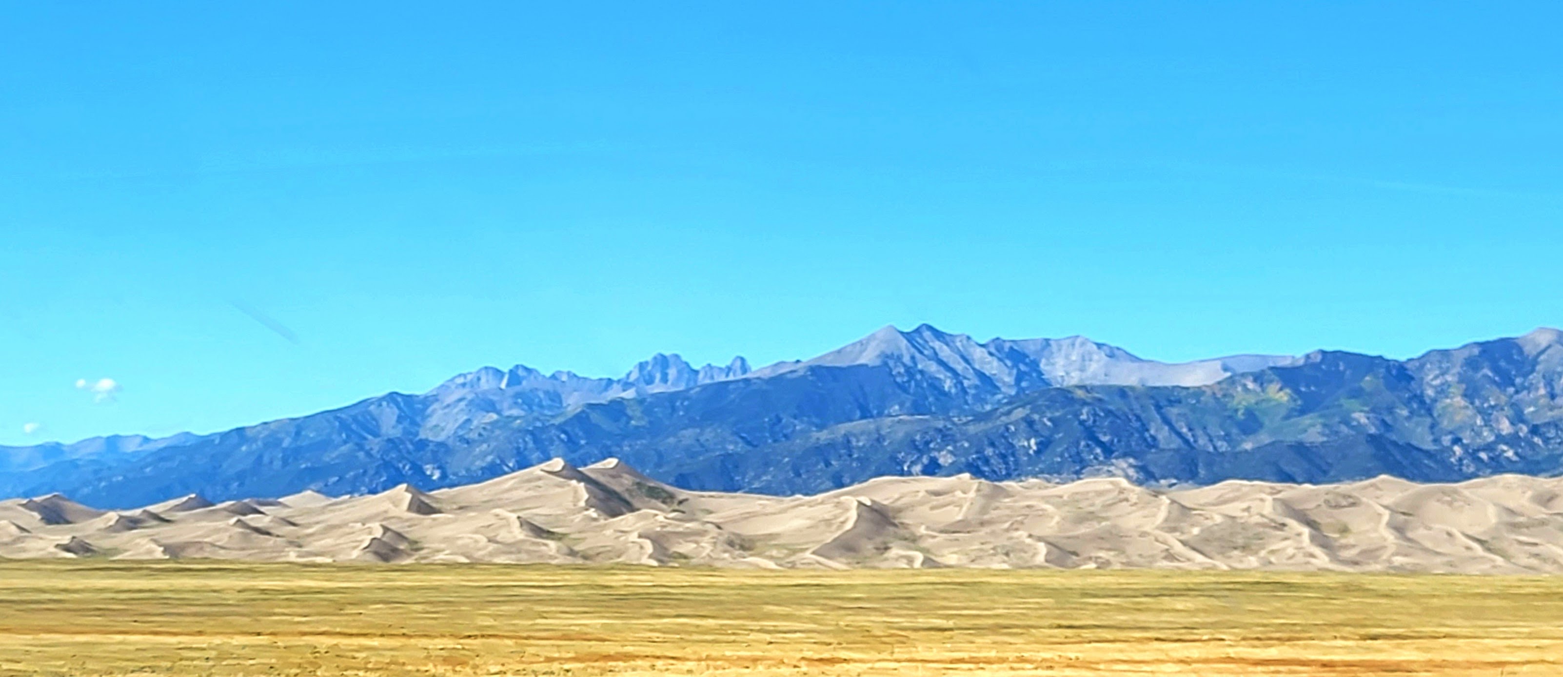
Again, the view of the San Luis Valley, with the San Juan Mountain Range in the distance was spectacular! Such wide open flat, yet elevated land!

We also had a view of the Great Sand Dunes National Paek in the distance. They are the tallest sand dunes in North America!

Please click on the collage above twice to enlarge the
two informational placards about the dunes at the overlook.
Come back to my blog next week to learn more about the sand dunes--they are a spectacular sight!