Showing posts sorted by date for query Pikes Peak. Sort by relevance Show all posts

Sunday, July 12, 2026

Four Mile House Historic Park

Four Mile House is the oldest standing structure in the city of Denver, Colorado!

The oldest portion of the house was built in 1859, and the location served as the last stagecoach stop before entering what was then the "Colorado Gold Rush" city of Denver, on the Wells Fargo Butterfield Stagecoach route between El Paso and Denver.


Routes from the plains towards the Front Range of the Rocky Mountains.
 
The Colorado Gold Rush, originally known as the Pikes Peak Gold Rush, started in 1858 and was the second largest mining excitement in United States history after the great California Gold Rush a decade earlier. Over 100,000 people participated in this rush and were known as “Fifty-Niners”, a reference to 1859, the year the rush to Colorado peaked.

“Pikes Peak or Bust” was the motto of many emigrants, a reference to the mountain in the Front Range that guided many early prospectors westward over the Great Plains.

Gold Rush Prospectors

Gold prospectors were the first major non-native population to enter the region, leading to the creation of many early towns, including Denver, Boulder, Golden, and numerous smaller mining towns, some of which are still active communities today.

As prospectors flooded the region in search of quick riches, the rapid population growth led to the creation of the Colorado Territory in 1861 and to the U.S. State of Colorado in 1876.

The rear of Four Mile House

Four Mile House was built in late summer or fall 1859 by the brothers Samuel and Jonas Brantner. In 1858, Jonas had come to Colorado from Ohio to look for gold. After prospecting unsuccessfully on Cherry Creek and the South Platte River, he gave up and staked a farming claim along Cherry Creek.

In August 1859, Jonas’s brother Samuel arrived in Colorado, and they soon built a two-story log house on Jonas’s land. Samuel, his wife, and their infant daughter occupied the house in October 1859.

 The house might have acquired the name “Four Mile House” in 1859 or 1860, when part of the Cherokee Trail began to be used by mail carriers traveling between Colorado City (now part of Colorado Springs) and Denver as well as by immigrants following the Smoky Hill Trail from Kansas to Denver. It was four miles from the house to Broadway in the city of Denver.


In 1860, the Brantners sold Four Mile House to Mary Cawker. A widow from Wisconsin, Cawker moved into the house with her two children that September. She operated it as a stage station with a bar downstairs and a tavern, and held dances on the second floor.


 Over the next decade, stages regularly stopped at the house to change horses and to allow passengers to change clothes and freshen up before they arrived in Denver after their 700-mile, 12-week journey across the midwestern and high desert plains.

Mary Cawker sold the house to Levi Booth for $800. An attorney originally from Wisconsin, Booth moved into the house with his family in August 1864. He continued to operate the house as a stage stop and tavern for the rest of the decade.


Over the years, the current U-shaped plan evolved as three buildings were butted together to accommodate changing needs. Together, the 1859 squared log construction, the circa 1860s woodframe construction, and the 1883 brick portions reflect the evolution of rural housing during the Denver area’s early settlement period.

Glendale neighborhood of Denver in the distance of the Four Mile House grounds.


In 1946, the Booth family sold Four Mile House to Glen Boulton, who stayed there for nearly thirty years. During those years, the house, previously on the edge of the city, was surrounded by development as Denver spread southeast and Glendale became an enclave of businesses and bars. In response to encroaching development, preservationists worked to ensure Four Mile House’s survival. In 1968, the house became a Denver landmark, and in 1969, it was listed on the National Register of Historic Places.


In 1977, the nonprofit Four Mile Historic Park Inc. was formed to care for the property, which was opened to the public the next year as a living history museum.

One of the members of our friends group had volunteered as a tour guide for many years at Four Mile Park, and she decided to plan an outing for us to take a self-guided tour of the park and house, and then have lunch afterwards at a local restaurant.

Click on the collage to enlarge it.

We enjoyed looking at all the interesting history exhibits about Four Mile House in its Visitor Center...


...and then strolling the grounds to see how the land had been developed as a farm in the late 1800s, which included a school house...


... and a blacksmith shop, a summer kitchen, and a barn housing 1800s era transportation vehicles.


We had a guided tour of the inside of Four Mile House with a volunteer who told us more of its history.

Four Mile Historic Park is a great resource for educators and students to learn about Colorado’s early history and hosts many events for all ages during the year.


If you are a history enthusiast, and would like to learn more about Four Mile House there is an interesting PBS Experience show about it on YouTube with fascinating vintage photos of the covered wagons and stagecoach rides--see video above.

We we all so glad to see that Four Mile House was preserved and is now a wonderful view back into the pioneer days of our nation's history.


Sunday, March 2, 2025

Garden of the Gods in Colorado Springs


A Beautiful view of 14,107-foot (4,299.83 m) Pikes Peak from the Garden of the Gods in Colorado Springs.


 As I have written in my past few blog posts, my best friend Rosemary visited us last March from Brooklyn, New York, and we spent a few days showing her our favorite Colorado sites. We went to Red Rocks Amphitheater, and walked along giant red rocks onto its stage, drove along the Peak to Peak Scenic Byway through canyons and mountain valleys, spent an afternoon admiring the beautiful snow-covered mountains in Rocky Mountain National Park, and on our last day together we drove down to visit the Garden of the Gods in Colorado Springs.


As Garden of the Gods is a National Natural Landmark and is one of our favorite places to visit I have blogged about it many times, as you can read in sequence on this blog tab. We always begin with a visit to the Garden of the Gods Visitor Center to enjoy its interesting exhibits.


The "Kissing Camels" Formation

We drove around the 1,367 acres of the park to admire the outstanding geologic features of the park. There are magnificent ancient sedimentary beds of deep red, pink, and white sandstone, conglomerates, and limestones that were deposited horizontally but have now been tilted vertically by the immense mountain-building forces caused by the uplift of the Rocky Mountains and Pikes Peak massif. You can read about the history of the park on this link.


This is a photo of Rosemary and me at the Balanced Rock formation, which is at 6,286 feet (1915.9 M) elevation in the park. Doesn't it look like the rock could topple over at any minute? It is a favorite photo spot for all visitors.


A close-up


There are so many beautiful rock formations in the park


We enjoyed stopping to admire many views during our visit.


Please click on the photo above to enlarge it in order to read the placard.

We stopped briefly in the nearby town of Manitou Springs to show Rosemary the iconic mineral springs.


Please click on the photo above to enlarge it to read the placard--March is Women's History Month!

Manitou Springs is an interesting and historical town--I wrote a blog post about it a few years ago which you can read here.

It was time to drive back to our town where we were going out to a goodbye dinner with Rosemary as she was flying back home the next morning. We wanted to show her so much more, but it will have to wait until her next visit which will hopefully happen very soon!


Monday, October 3, 2022

A Hike to Zapata Falls


Last week my husband and I decided to take a quick trip to Southern Colorado to see some iconic sights as an early anniversary celebration. We usually like to wait until early October to do a long drive as fall arrives early in Colorado and the aspens begin to turn gold. Autumn is my favorite season as I love the cooler temperatures and beautiful colors of nature.


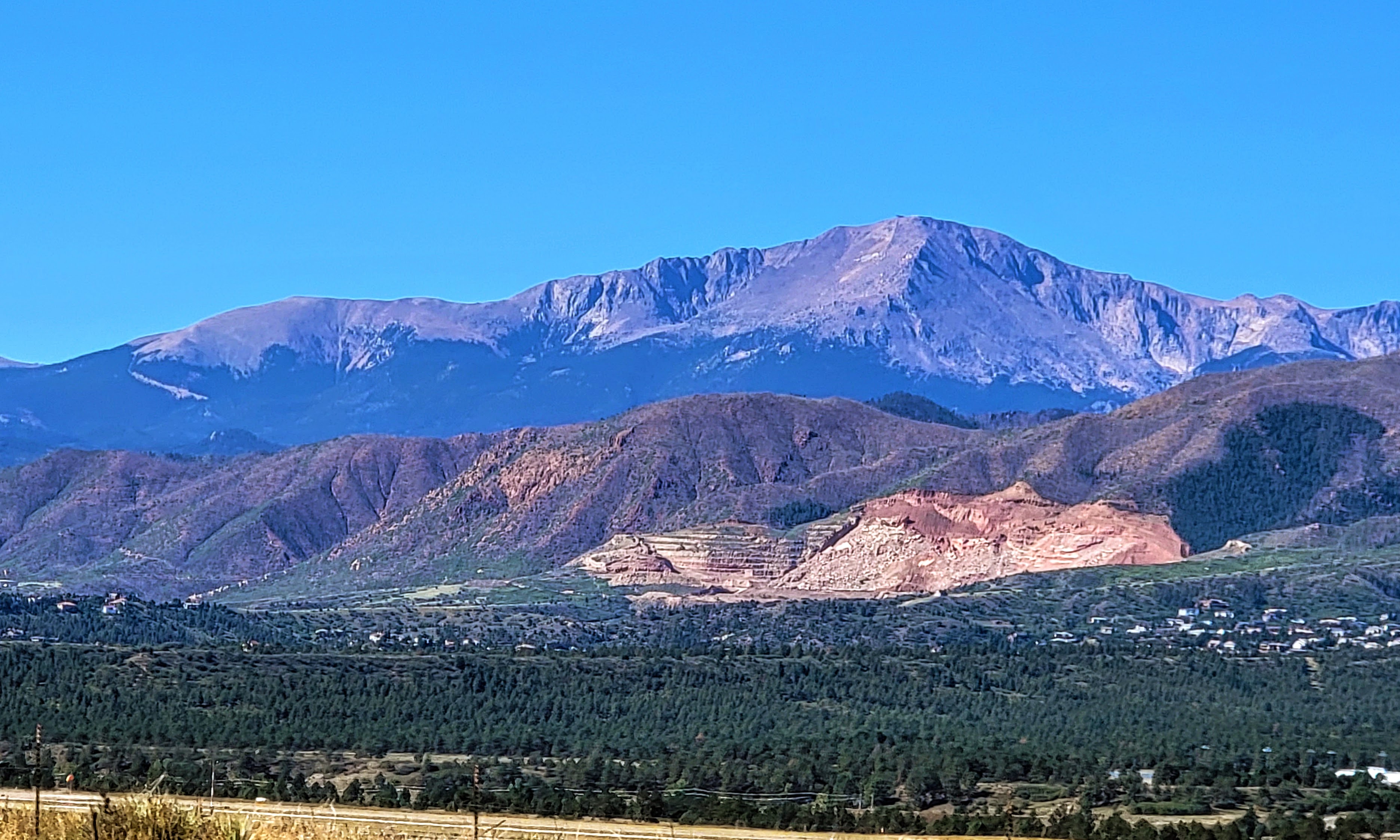
We drove past Pikes Peak also known as "America's Mountain" 

Pikes Peak is a 14,115-ft. pink granite peak featuring hiking trails with stunning views, climbing & campgrounds.  You can read a post about our first drive up to the mountain's summit on this link, and our last trip in 2021 when many changes were taking place at the summit--click here--to see that post.


As we continued driving south we finally reached the San Luis Valley which is rimmed by the Sangre de Cristo Mountain Range. A view of Mount Blanca is above,  It is the fourth highest summit of the Rocky Mountains in Colorado, and at 14,351 feet (4,374 m) it is the highest summit of the Sangre de Cristo Range.  

I blogged about this beautiful peak in a prior post, in which I also explained why Navajo Native Americans consider the peak sacred--click here--to read that post


We could see some colorful aspens on some of the mountains' higher elevations.


We visited this part of Colorado a few years ago but did not have a chance on that trip to hike up to see Zapata Falls, so this time we wanted to accomplish that task. We soon approached the Zapata Falls Recreation Area. 

Zapata Falls is a waterfall located near the base of the Sangre de Cristo Mountains on Bureau of Land Management land adjacent to Rio Grande National Forest and south of Great Sand Dunes National Park.


As we drove up the road leading to the parking lot beyond the Zapata Falls Campground area we had a wonderful view of a part of the San Luis Valley.

The San Luis Valley is over 50 miles wide and over 100 miles long, at 8,192 square feet (21,000 km) with an average elevation of 7,664 feet (2,336 m) above sea level. It is larger than some American states!


Please click on the collage above twice to enlarge it fully for an easy view of the placard information at the trailhead.

We parked our car and began to hike, passing the informational signs above.  They explained that the hike ahead would be a half mile each way, and have a 400-foot elevation to 9,400 feet. They also explain how the area is a moraine formed by a glacier two million years ago.


Please click on the collage  to enlarge it for a full-view

The hike up was very rocky and soon followed alongside the South Zapata Creek


At certain points, the cold creek had to be crossed over to continue the hike.


As you can see and hear in my video above the creek water was running fast and loud!


It was slow going for us as we were trying to be very careful not to fall on the slippery rocks. I did fall once but was able to recover quickly without getting too wet.


We saw younger and more agile hikers taking different approaches along the rock walls of the slot canyon. At one point my husband thought we should turn back, but I was determined that since we came this far we should keep going.


We were glad we did keep going! 

As you can see from the video above the thunderous 25-foot-long waterfall was pounding down inside a slot canyon.  Be sure to look all the way to the top.  We felt we could not go in any further to get a full view as the water was cold and getting deeper, so I leaned in as far as possible to get this video on my phone.


This area is just as impressive during the winter months when the falls freeze into an enormous column of ice!  Our daughter did this hike in early spring when the falls were frozen yet still could be heard running underneath the thick ice.


It was exciting for us to have made it this far!


Considering that it was almost October the falls were still fairly full.  I imagine in late spring they would be even more full and really roaring with snow melt!


After recrossing the creek a few times we began the rocky half-mile walk back down to our car 


Again, the view of the San Luis Valley, with the San Juan Mountain Range in the distance was spectacular!  Such wide open flat, yet elevated land!


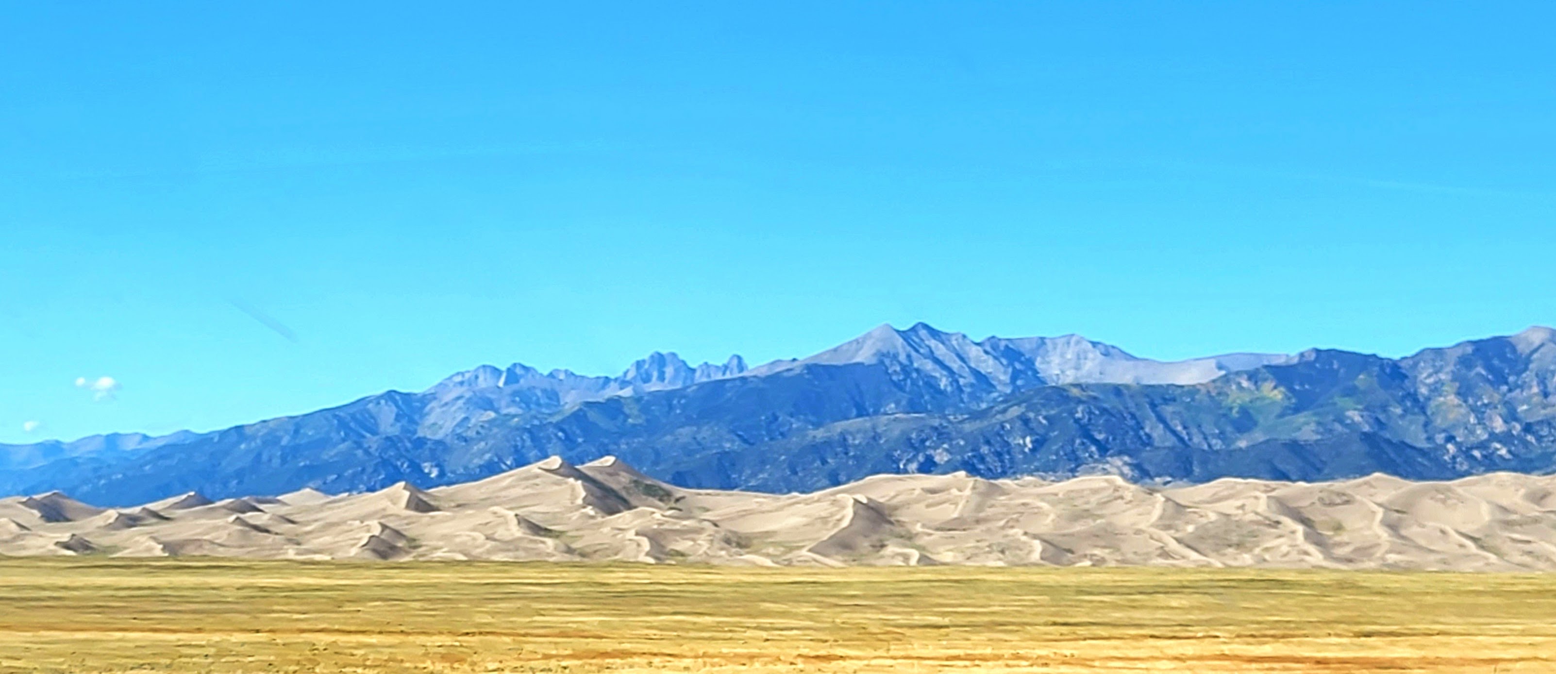
We also had a view of the Great Sand Dunes National Paek in the distance.  They are the tallest sand dunes in North America!

The dunes cover an area of about 30 sq mi (78 km) and are estimated to contain over 1.2 cubic miles (5 billion cubic meters) of sand.


Please click on the collage above twice to enlarge the 
two informational placards about the dunes at the overlook.


Come back to my blog next week to learn more about the sand dunes--they are a spectacular sight!


You can also find me on


Monday, August 8, 2022

Part Two: Mount Evans and a Farewell to Echo Lake Lodge


In last week's blog post, Above the Clouds on Mount Evans Part One, I showed what it looked like to drive up North America's highest paved road to 14,260 ft (4,346M) on a rainy, cloudy day.

 After taking some quick photos in the rain at the summit, at a cold temperature of 40 degrees (4.444 C), we were on our way back down the mountain to go back to drier and safer ground.


Please click on this to enlarge


As you can see in the upper section of the photo collage above there is a  U.S. Geological Survey brass plaque on one of the highest boulders on the summit of Mount Evans, placed there in 1955 which states "Elevation Above Sea level 14,258." 

The bottom photo in the collage shows an infographic located at Summit Lake, which is located at 12,840 feet (3,913.632 M) on the mountain. It describes the five life zones one will drive through on their way from Denver, Colorado to the summit of Mount Evans--from mile-high grasslands at 5280 ft to alpine over 14,000 feet. It really is amazing to see the different terrain.


The alpine environment is where mountain goats, marmots, and bighorn sheep call home year-round.


On the drive back down I could see the 14,065-foot summit of Mount Bierstadt in the distance,  It is also located in the Mount Evans Wilderness area.


As we descended I could see the fog lifting up from below.


The lower we traveled back on the switchback road the higher and greater the fog seemed to appear.


We were definitely still above the clouds!


It was still raining and the road was slippery and wet.


We could see a deep fog approaching...


...closer...


...until we were engulfed inside it! 

At this point, my husband drove very carefully as he could barely see the road in front of us.


I took photos of the clouds in the distance off to the side.


We slowly kept descending...


Although the views on a clear day are spectacular, it was also magical to see all the vistas covered with clouds this day.


The heavy cloud cover filled the sky above as we drove lower in elevation...


...it still felt like being in heaven!


Finally, we were back at tree level.


Echo Lake at the base of the mountain was still very foggy.


We stopped for lunch at the historic Echo Lake Lodge.


Please click on this to enlarge


Echo Lake Lodge, built in 1926 by the City and County of Denver, was designed to provide accommodations to Denver Mountain Parks visitors. Today, it is used only as a gift shop and restaurant.

The initial construction was the octagon-shaped part of the lodge and the rest of the building was added in 1927.  At 10,600 ft elevation, Echo Lake Lodge was used as a high-altitude training camp for the military during WWII.

In 1965, Denver Mountain Parks leased Echo Lake Lodge to H.W. Stewart Inc. H.W. Stewart is a fifth-generation family-owned family company that still operates Echo Lake Lodge to this day.  Sadly, this is their last year as Denver Mountain Parks did not renew their contract!  The lodge infrastructure needs heavy repairs.  Its indoor bathroom has been unusable since last summer, so Portosans had to be brought into the parking lot.


Every time we drove to Mount Evans in the past--almost once a year since living in Colorado--we would stop at Echo Lake Lodge for either a slice of homemade pie or to have lunch. Their Buffalo Chili was one of our favorites, so we made sure to order a bowl of it one last time.  I also enjoyed shopping in the well-stocked gift shop. 

 It's sad to know that this is its last year of business.  Pikes Peak in Colorado Springs had an ultra modernization of all its facilities a few years ago and I have a suspicion the same will happen for this structure when its replacement reopens in a few years.  We bid it a fond farewell--a piece of the Colorado past disappearing! 

Mount Evans Scenic Byway is open approximately from Memorial Day to Labor Day, weather permitting--a reservation is required and must be made before your visit and printed or downloaded as the area has no cell phone service.  Please remember to leave no trace! Take only photos, leave only footprints (on the trails).

You can also find me on


Bookmark and Share