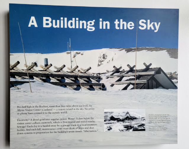
"Perched high in the Rockies, more than two miles above sea level, the Alpine Visitor Center is isolated--a remote island in the sky." says the placard inside this Rocky Mountain National Park structure in Colorado--click on the photo to enlarge it to view it easier. Standing at 11,796 feet, (3,595.42 meters), the Alpine Visitors Center is the highest visitor center in the national park system. The Alpine Center opened in June 1965 and is only accessible part of the year (generally about Memorial Day to sometime in October) based on the seasonal opening and closing of Trail Ridge Road.
It was early June when my husband and I had a full day to explore the park and--click here, here, and here to see our visits the prior day to three Rocky Mountain National Park lakes. They are among many lakes in the park, but the easiest to walk around as they are located within parking distance. We usually visit the park in the fall season and this is a post of the Alpine Visitors Center in the autumn of 2014.
We had our park's pre-ordered timed entry permit available when we arrived at the entrance. Many popular US national parks are instituting these entry reservations as a way to manage crowds and make visits more enjoyable for all. Rocky Mountain national park had over 4 million visitors in 2022, so it is among the more popular national parks.
Rocky Mountain National Park has the nickname the "Land of Extremes" and that was quickly recognized as we drove to higher elevations. and saw plowed high snow walls and lower temperatures remember this was the first weekend in June! Rocky Mountain National Park's 415 square miles (265,807 acres) encompasses a spectacular range of mountain environments. From meadows found in the montane life zone to glistening alpine lakes and up to the towering mountain peaks, and over 300 miles of trails and abundant wildlife.
We traveled on the main road in the park --Trail Ridge Road -- also knowns as U.S. Highway 34-- stretches 48 miles (77 km) through Rocky Mountain National Park, connecting Estes Park, Colorado to Grand Lake, Colorado. With a high point at 12,183 feet (3,713 m) elevation, Trail Ridge Road is the highest continuous paved road in North America. The higher portion of Trail Ridge Road is closed from October to May.
The views of the Rocky Mountains are spectacular! You really do feel as if you are on top of the world!
The high poles on either side of the road are there to guide the snowplows when the road is plowed open.
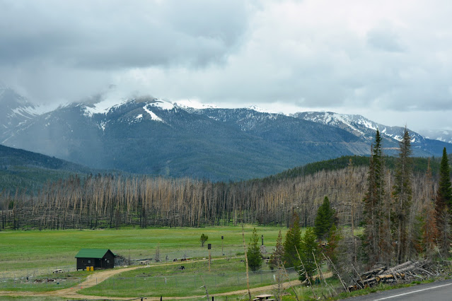
On this day multiple clouds were being formed on the mountains, and it was foggy and overcast.
We climbed above the tree line into the alpine tundra at the top of the mountains...
Designed to sustain terrific winds and blizzards, this large structure uses a steel frame and concrete shell, sheathed in a rubblestone veneer and held down by a lattice of large logs on the roof.
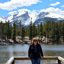
In this photo collage, I'm standing next to snow that was still located in front of the center! It was a little early before the center opened so we walked around and took photos and read the interesting informational placards located outside.
Please click on the photo to enlarge it
This placard describes how clouds are formed by the mountains.
Please click on the photo to enlarge it
Descriptions of wildlife and plant life of the tundra.
Please click on the photo to enlarge it
More interesting information about the tundra at this elevation.
A fellow visitor took our photo!
We had coffee in the cafe inside the Alpine Center when it opened.
Just look at all the snow still outside the back patio!
We also enjoyed looking at all the exhibits inside the center...click on each one to enlarge it...
The word tundra means "land without trees." One-third of Rocky Mountain National Park is easily accessible by the alpine tundra.
This explains how no road in any other US national Park takes you so high!
There were a variety of exhibits in the center showing animals and flowers and plants that grow in the tundra.
T
his placard explained the Old Fall River Road was the original road in the park from 1920 to 1932.
It is a 9-mile scenic drive beginning at the Endovalley Picnic Area and ending at the summit of Fall River Pass and the parking area for the Alpine Visitor Center at an elevation of 11,796 feet. This road is a narrow dirt road that is one-way uphill only with sharp switchbacks.
For over 10,000 years before Europeans came to America, Native people lived hunted, and thrived in what is now Rocky Mountain National Park--among them the Ute, Arapahoe, and Cheyenne.
The Ute Native Americans called the Rockies "The Shining Mountains" and felt they were closer to their creator when in the mountains. Many of the trails within the park are centuries-old original paths made and used by the Native Americans.
After our stop at the Alpine Visitors Center, we continued to drive on Trail Ridge Road west towards the Continental Divide and the western part of Rocky Mountain National Park.
Please come back to join me on that blog post next time!
You can also find me on
Mosaic Monday, Blue Monday, Through My Lens Monday, Hearth, and Soul Link Party, You Are the Star Blog Hop, Inspire Me Monday, Nature Notes, Home Matters Linky Party, Senior Salon Pit Stop, Good Random Fun, Happiness Is Homemade, Ruby Tuesday, Tuesdays With A Twist, Pictorial Tuesday, Wordless Wednesday on a Tuesday, Wordless Wednesday, Wednesday My Corner of the World, Wonderful Wednesday, Little Things Thursday, Thursday Encouraging Hearts and Home, Thursday Favorite Things, Skywatch Friday, Friendship Fridays, Pink Saturday, Saturday Sparks, Saturday Critters, Sunday on Silverado


