Showing posts sorted by relevance for query Pikes Peak. Sort by date Show all posts

Sunday, September 19, 2021

What's New On Pikes Peak!


At the beginning of September, a former colleague of my husband was visiting Colorado Springs with her husband for a convention.  We live about an hour away in the Denver area, but we offered to drive them up to the top of Pikes Peak in Colorado Springs on a day they were free, and after they acclimated to the elevation of Colorado Springs. We heard that many new features were being built on the top of the 14,115 foot (94302.32 m) mountain which would be interesting to see in progress.  Pikes Peak also called "America's Mountain" is one of the most visited mountains in the world and a top tourist attraction for the State of Colorado. Annually, nearly 1 million people reach the summit via the Pikes Peak Highway, The Broadmoor Manitou and Pikes Peak Cog Railway, or, for the more adventurous, the Barr or Crags hiking trails. Pikes Peak is an American icon, and the summit is a National Historic Landmark that holds a special place in America's heart.

We have made many drives up to the summit of Pikes Peak, and in this post, you can see a more detailed ride up and down the mountain. In this post, you can learn about the town of Manitou Springs which lies at the base of Pikes Peak, and within this post, you can see a trip we took on the Cog Railroad up to the summit of Pikes Peak with my younger brother who was visiting one year. 


Although the sky was uncharacteristically hazy, due to western wildfire smoke in the atmosphere, the view on the drive up was still breathtaking.


As you can see in the photo above there are many switchbacks on the road up the mountain.


There are also some places along the drive where you feel as if you are going to drive right off into the clouds!


For the faint of heart, The Broadmoor Manitou and Pikes Peak Cog Railroad does the driving for you and is fully narrated with interesting historical facts. The Cog Railroad has been functioning since 1891, but in the last few years, it has been completely overhauled by its owner, The Broadmoor Hotel and Spa, with new trains, new tracks, a new depot, and a new Pikes Peak Visitor Center to become one of the most unique experiences in the world. 


There was still snow on the ground from a light snowfall that occurred a few days before and the views from the summit, although hazy in the distance, went on for many miles.


There were still many construction vehicles and work in progress at the summit.  It is amazing to think of how those large construction machines and supplies drove up to the mountaintop and have worked, weather permitting, constructing new view platforms, a new parking lot, new walkways, and a new Visitor Center Complex! As you can see in the collage above most of the mountain top at one time was a boulder field. The older Visitor Center built in the '60s was being knocked down.


The new Visitor Center is open although finishing touches were still being made inside and around it.


The new Pikes Peak Summit Complex, which includes the Visitor Center, a utility facility, and a High-Altitude Research Laboratory. has large windows to see the views, a gift shop, restrooms, an interactive display room, and a cafeteria. My husband and friend sampled the legendary high-altitude donuts.


We also watched another cog railway approach the summit from the back porch of the Visitor Center.


A wall of the original 1873 Summit House has been preserved.  Click on the photo to enlarge it to read the informational placard about it in the collage above. 


There were many other interesting informational placards on the new railings--click twice on the photo collage above to enlarge them to read them.


There is also a new modern Summit Sign! It has the new exact measurement of 14,115 feet on it.  We all posed for photos by it. The original 1907 US Geological Survey medallion can be seen on the ground in front of the sign.  


The drive down the mountain was also exciting. We stopped for a while at an area called the Devil's Playground where I took a photo of our friends taking a selfie. 

The Devil's Playground Trail (also known as the Crags Trail) traverses approximately 7 miles and 4,300 feet starting from a trailhead located near the Crags Campground (Woodland Park, CO) and terminating at the summit of Pikes Peak, elevation 14,115 feet. The trail is located entirely on the USFS Pike National Forest.


We continued on until we had the mandatory stop for a brake check at the Glen Cove station on our descent.  Even though my husband followed all the Pikes Peak suggested driving rules our brakes measured hot and we were told to pull over to cool them for a half-hour. It was the first time that happened in all our drives but this was also the lightest traffic we encountered in all our trips up and down the mountain so we may have been going a little faster than usual.  We were able to buy coffee and peruse the gift shop during our stop so all was well.  

We had a wonderful time on the mountain and afterward our guests treated us to a delicious lunch. It was so nice to spend the day with our friends and we know they enjoyed the rest of the time they spent in Colorado. Meanwhile, my husband and I are excited to plan to return next summer to Pikes Peak to see the completion of all the improvements and to enjoy the views again!

You can also find me on

Bookmark and Share

Sunday, August 2, 2015

Pikes Peak or Bust!


There it is--Pikes Peak! At 14,115 feet it is called "America's Mountain."The saying "Pikes Peak or Bust" was a familiar slogan when I was a child. It was a saying that became popular during the Colorado Gold Rush of 1859 when over 100,000 men rushed west to the Rocky Mountains in search of gold, and pioneers headed west with hopes for a better life. It later became a rallying cry used when someone was trying to describe a dream they hoped to accomplish by every means possible. The phrase certainly fired my imagination! (All photos and photo collages will enlarge for easier viewing if clicked on)


The story of Zebulon Pike's discovery and attempted conquest of the mountain names after him. Click on the photo to enlarge it. This placard is located on the Riverwalk in Pueblo, Colorado.
This is the third summer we've lived in Colorado, and even before we lived here, I wanted to drive up this mountain that I heard so much about my entire life. My husband and I decided last weekend that the day had finally arrived when we would drive south to Colorado Springs and conquer the mountain! It was not without some trepidation, as last summer we found the drive up the equally high Mt. Evans (click here to read that post) quite a thrilling drive, and we were a little nervous if the road up Pikes Peak would prove to be the same, and if the weather would cooperate with our drive.


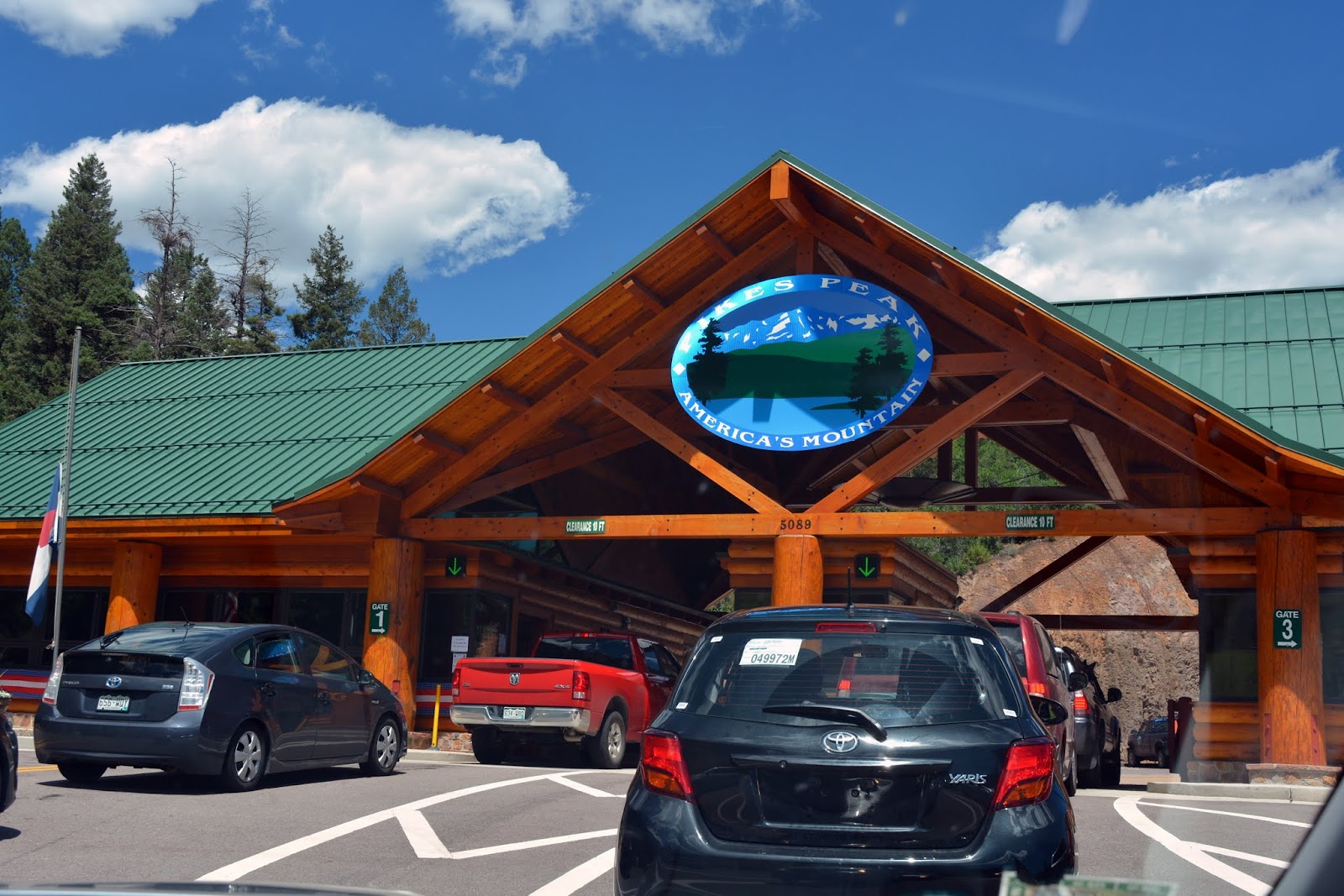
We paid the fee to drive up the 19 miles long Pikes Peak Highway at the road's toll gate and we were on our way!


The road was wide and well paved. We were advised by a ranger at the beginning of the highway to make sure we had half a tank of gas and to keep our car's air conditioner off.


The road was definitely rising higher with each turn, but it did not feel too precarious.


We passed gentle slopes of pine trees for much of the first miles


As we climbed higher the terrain became rockier.


As a passenger, I could see the Pikes Peak Highway and valley views behind us as we drove higher.


We were soon driving above the tree line, at over 11,000 feet, and were at about the 13-mile mark on the highway. You can read about the different climate zones the Pikes Peak Highway passes through on this link.


There were stops along the way on the highway, that allowed visitors to explore different areas of the mountain, but we wanted to drive straight up and not stop, as we were hoping to avoid the usual thunderstorms that occur most afternoons. There is an area near this point called the "Devils Playground" due to the way lightning dances from rock to rock during a thunderstorm.  That must be a sight to see!


The views on the way up the mountain were breathtaking!


As you can see from this photo, the highway is composed of many long switchbacks, which makes the drive up easy to navigate.


Even though this was the last weekend in July. we saw patches of snow!


More winding road ahead.


The higher we rose in elevation,  the more desolate the terrain appeared, full of tundra grasses, mosses, sedges, and lichens. It is at this altitude that the Colorado State Mammal, the Rocky Mountain Bighorn Sheep live, but we did not see any on our journey up.


I had a wonderful view of Glen Cove and Crystal Creek Reservoir in the distance.


At one time the last few miles of the Pikes Peak Highway were not paved, but now the road extends all the way to the summit. At this point, the driver can really feel the high grade and sharper turns, but we both felt quite safe.


It was thrilling to feel as if one was driving into the clouds!


We finally reached the summit!  The summit is very wide and flat with plenty of parking space.  We could see the Summit House, which is a gift shop and cafe, and a marker bench sign.  There is also an Army weather station on the summit that is not open to visitors.


Some of the summits were extremely rocky...


...but there were plenty of areas that enabled magnificent panoramic views!


Again, the sensation we had of almost being able to reach up and touch the clouds was mesmerizing!


My husband and I hopped up onto the Pikes Peak bench to have our photo taken.


We then walked around the summit to enjoy all the views! 


Thankfully, the weather remained good for our entire visit! The weather at Pikes Peak summit can easily be 30 to 40 degrees cooler than the weather at the base of the mountain, but since it was a 90-degree day in Colorado Springs it was a tolerable 55 degrees at the summit. You can check the present weather on Pikes Peak at this link.  Also, it is good to remember that at this altitude you are only breathing 53% oxygen!  If you are visiting Colorado from another state, and have not acclimated your body to the lower level of oxygen at a mile high, you will certainly feel the effect of being almost 3 miles above sea level!


From an observation deck, we could see visitors exploring the terrain.


We also watched hikers reaching the summit from the Barr Trail that ends at the summit near the Cog Railway tracks. Hiking the trail is a feat of endurance as it is 13 miles long and rises 7,510 vertical feet in elevation from its base, and that is one way! 


Also, located on the observation deck, is the "America the Beautiful" monument, as well as other memorial plaques.  In 1893, Katherine Lee Bates, an English teacher from Wellesley College in Maine was invited to teach a summer reading course in Colorado Springs. She was so impressed by her 2,000-mile journey west and a visit to the summit of Pikes Peak that she composed the poem/song America the Beautiful. You can read the entire story at this link.


There was another plaque in an area near the parking lot that caught my attention.  It was a memorial plaque for Carl Lotave, who died in 1924 and whose ashes were interred underneath it. Lotave was a Swedish-born artist who became famous for his portraits and scenes of the southwest and Native Americans for the Smithsonian Museum.


Another summit view.


The ruin of the original Summit House that was built in 1873. A timeline of the history of Pikes Peak can be read on this link.


For those that do not wish to drive up and down the summit of Pikes Peak, you can take the Cog Railway. My husband and I hope to take the railway one day to have this experience, and I will definitely blog about it.


Sorry for the blurry photo, but I wanted to show you the famous Pikes Peak donut that you can buy inside the Summit House.  They are the only donut in the world made at over 14,000 feet, using a secret recipe.  They are light and delicious! You can watch a Youtube video about the donuts on this link. 


After enjoying the summit of Pikes Peak for a couple of hours we decided it was time to head back down the mountain and return home.  We were surprised to see that even in the late afternoon there were still many cars making the ascent.


Again, the views were outstanding!


Wildflowers growing among the boulders.


We followed instructions to drive down the mountain using low gear, and to try not to use our brakes continuously.


I could feel the decent grades much more than on the ascent going up.


Some of these rocks that we passed seemed precariously balanced!


We slowly descended back to the subalpine and Montana regions of altitude. 


At the halfway point, near the Glen Cove Inn, cars are asked to stop by a Ranger for a brake check.  If your car's brakes are not overheated you can continue on your way. If your brakes show signs of stress you are asked to pull over for a length of time in the inn's parking lot to allow them to cool, for your safety.  The Glen Cove Inn has restrooms and a restaurant and a gift shop.  Happily, our brakes were good so we continued on our way.


Soon we were back to the entrance area of the Pikes Peak Highway, completing our trip and another wonderful Colorado adventure!


One last look at Pikes Peak on our way home.  We did it! "Pikes Peak or Bust!" We conquered the mountain and I know we will be back to do it again someday!


Bookmark and Share