We enjoyed a nice Father's Day barbecue celebration at our home this past Saturday. We celebrated a day early because the weather forecast for Sunday predicted rain, but I should have known better, because it turned out to be a beautiful day on Sunday.
In typical Colorado fashion, the weather was unpredictable!
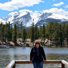
It made me scroll through the sky photos in my collection since moving to Colorado thirteen years ago...

The Spring and Summer seasons often bring the most amazing cloud formations!
These towering, high, full clouds are called Cumulonimbus Clouds, and when I see them, this is what I think of...

...hail!
The first year we moved to Colorado, we experienced our first large summer hail storm. At first, we thought it was fun, as we had never seen such large hailstones. The streets and lawns looked like they were covered with snow in August. My husband joked that he never thought he'd need to shovel in summer. Fortunately, I thought to go down into our basement and was shocked to see a waterfall of melting hail come pouring in through our window wells. I used almost every towel I owned to mop up that water as it seeped through.
Similar to hail is Grapel -- a new word we learned that first winter. Graupel is precipitation that forms when supercooled droplets of water freeze on a falling snowflake. It looks and feels like large drops of slushy ice falling from the sky!

A virga, also called a dry storm, is an observable streak or shaft of precipitation that evaporates or sublimates before reaching the ground. It is a new phenomenon to us, and another new weather word we learned.

Of course, we do get our share of thunderstorms. This one was approaching the city of Denver a few summers ago.

In years such as this one, when the West had unusually dry weather with very low snow and rain levels, we worry about lightning strikes causing wildfires, but rain is seen as a blessing for our high desert climate...

...and rainbows are always a welcome sight to see!
Speaking of rainbows, we learned another new weather word when we moved to Colorado...

Iridescent clouds are a diffraction phenomenon caused by small water droplets or small ice crystals individually scattering light. We usually see this in the winter months.


A beautiful assortment of different cloud formations in my neighborhood.

An angel cloud in the sky?

Sunrises and sunsets are reminders that, regardless of the weather, each new day is a blessing.
Happy Summer to all!
Please tell me what new weather words you have learned where you live.
I can also be found on
Blogs I link with:
Nature Notes, Home Matters Linky Party, Happiness is Homemade, Monday Morning Blog Club, Senior Salon Pit Stop, Talk About It Tuesday, The Happy Now Tuesday, Happy Tuesday, Wordless Wednesday 2, Wordless Wednesday on Comedy Plus, Wonderful Wednesday, Thankful Thursday, Weekend Traffic Jam Report, Thursday Favorite Things, Skywatch Friday, Weekly Wisdoms, Fantastic Friday, Farmhouse Friday, Crazy Little Lovebirds Friday Link Up, Dare to Share, Saturday Sparks, Saturday Critters,