

(All photos and photo collages in this post will enlarge if clicked on)

The Blackfeet people have lived near Chief Mountain for millennia, and believe the mountain holds great power and ancient knowledge. If you click on the photo above of the informational placard you can read more about the mountain.

Near this area, we turned from US Route 89 N to MT Highway 17, or Chief Mountain Highway. The roads gave us beautiful views! We were surprised quite a few times by cows from nearby farms and ranches standing next to, or crossing the road. We made sure to drive carefully.

We passed the Many Glacier parts of Glacier National Park (click here to read my blog post about that area) and then approached the Canadian border crossing where we stopped to show our passports. Highway 17 then turned to Alberta Route 6.

We then entered into Alberta, Canada where the Waterton Glacier International Peace Park is located.

As we approached the park entrance the views were beautiful.

This area is called "where the mountains meet the prairies."

We passed through the park toll booth. Unfortunately, our US National Parks Pass did not apply for free entrance as it does in the USA, so we had to pay admission. The Waterton-Glacier International Peace Park was created by the US and Canada in 1932, and in 1976 it was designated an International Biosphere Reserve. In 1995 it was inscribed as a World Heritage Site by UNESCO. The Peace park commemorated the peace and goodwill our two nations share and today Waterton Lakes National Park and Glacier National Park use peace and goodwill to work towards shared management in protecting the water, plants, and animals that are found in the shared area of the parks.

We almost immediately saw upper Waterton Lake.....

...where we bought tickets to take a boat ride by the Waterton Shoreline Cruise Company.

We could see the beautiful Prince of Wales Hotel and Restaurant on the hill in the distance--more about the hotel later in this post.

The boat cruises along the shoreline of the beautiful Upper Waterton Lake and crosses the International border to Goat Haunt, Montana. Waterton Lake is the deepest lake in the Canadian Rockies!

As we sailed away the Prince of Wales Hotel shrank in size. The high mountain next to it is called Bears Hump and there is a trail that leads to the top from the visitors center.

The narrated cruise is about an hour long each way with magnificent views!

We could see quite a few glaciers at the Goat Haunt area.

There was a half hour stop at Goat Haunt--the northern gateway to Glacier National park. We debarked at this beautiful sheltered and commercialized area to take a short hike along the shoreline. and to wade into the cold lake water.

The Waterton Lake bottom was filled with a pretty array of multicolored pebbles--the same as the other lakes within Glacier.

Inside the shelter were some placards about the history of the world's first International Peace Park--please click to enlarge to read.

Click to enlarge to read.

This placard explained that the events of 9-11-01 changed the concept of the International Peace Park borders to make this border crossing, that was once open to all nations, to be only available to US and Canadian citizens--a sad reality to increase national security.

There was also an interactive board where people could leave their ideas on how to be a peacemaker where they live. I found the answers interesting. What would you write?

Back on the boat to return to Canada, we could see the 49th Parallel Canadian/United States border. Canada and the USA have the longest undefended border in the world (5,525 miles/8,892 km.).

The return cruise sailed closer to the eastern side of the lake to see different views.

At one point the boat stopped to allow us to see this unusual shoreline rock formation.

When we went back ashore we were excited to visit the Prince of Wales Hotel.

The hotel was constructed between 1926 and 1927 by the American Great Northern Railway. The hotel is named after the Prince of Wales--later King Edward VIII. The bellhops wore red tartan plaid kilts and the plaid was also on display in the hotel lobby.
 |
There is a beautiful view of Waterton Lake from the hotel lobby. Tea was in progress and I regretted that I did not make reservations to indulge in it, but I knew we wanted to explore other parts of the park and did not have the time.
|

The history of the Prince of Wales Hotel--please click to enlarge to read.

This is the view outside the Prince of Wales hotel looking across Waterton Lake south towards Goat Haunt at the far end.

Another view from outside the hotel, looking east.

Unfortunately, we found out scenic Akamina Highway in the park was closed as it suffered serve damage the prior winter and had not yet been repaired. We then drove to Red Rock Canyon, passing beautiful mountain scenery along the way.

We hiked a trail that circumference a portion of Red Rock Canyon, where the layers of red and green colored minerals offered a brilliant contrast to the surrounding lush green surroundings. We watched visitors enjoying the water from various bridges that crossed over the canyon.

The day was approaching late afternoon so we headed back towards the USA border crossing, passing Chief Mountain again, and then onto US Route 89 where we re-entered Glacier National Park at the St Mary entrance, and returned west towards our hotel along the Going-to-the-Sun road. It was a very full day, but one filled with many glorious tights and memories we will never forget.
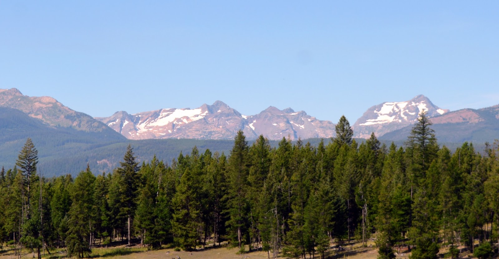
The next morning we checked out of our hotel to drive back to Colorado. This was our last look of Glacier National Park in the distance as we traveled south. We would love to return one day to see and experience more of the park. We've visited many National Parks over the years, and Glacier has now become one of our favorites. It truly earned it's nickname as the "Crown of the Continent." Thank you for coming along on my blog for the journey!
To see posts in this series that you may have missed--click the links below:
Glacier National Park -Part One--Many Glacier
Glacier National Park -Part Two- Trail of the Cedars
Glacier National Park-Part three--Hanging Garden Trail to Hidden Lake
Glacier National Park -Part One--Many Glacier
Glacier National Park -Part Two- Trail of the Cedars
Glacier National Park-Part three--Hanging Garden Trail to Hidden Lake
I'm linking this post to the following blog events:
All Seasons, Amaze Me Monday, Blue Monday, Through My Lens Monday, Mosaic Monday, Life Through the Lens Monday, Mellow Yellow Monday, Inspiration Monday, Good Random Fun, Nature Notes, Grand Social, Our World Tuesday, Ruby Tuesday,Wanderful Wednesday,Wordless Wednesday, Oh My Heartsie Girl's Wonderful Wednesday, Outdoor Wednesday, Share Your Cup Thursday,Little Things Thursday, Thoughts of Home on Thursday, Travel Photo Thursday, Friday Photo Journal, Skywatch Friday, Sweet Inspiration, Weekend Travel Inspiration, Friday Features, Pink Saturday, Saturday Critters
Thank you to all the blog hosts!




 Posts
Posts





