Showing posts with label WonderfulWednesday. Show all posts

Sunday, October 23, 2022

A Joyful Journey


The Colorado Sangre de Cristo Mountains

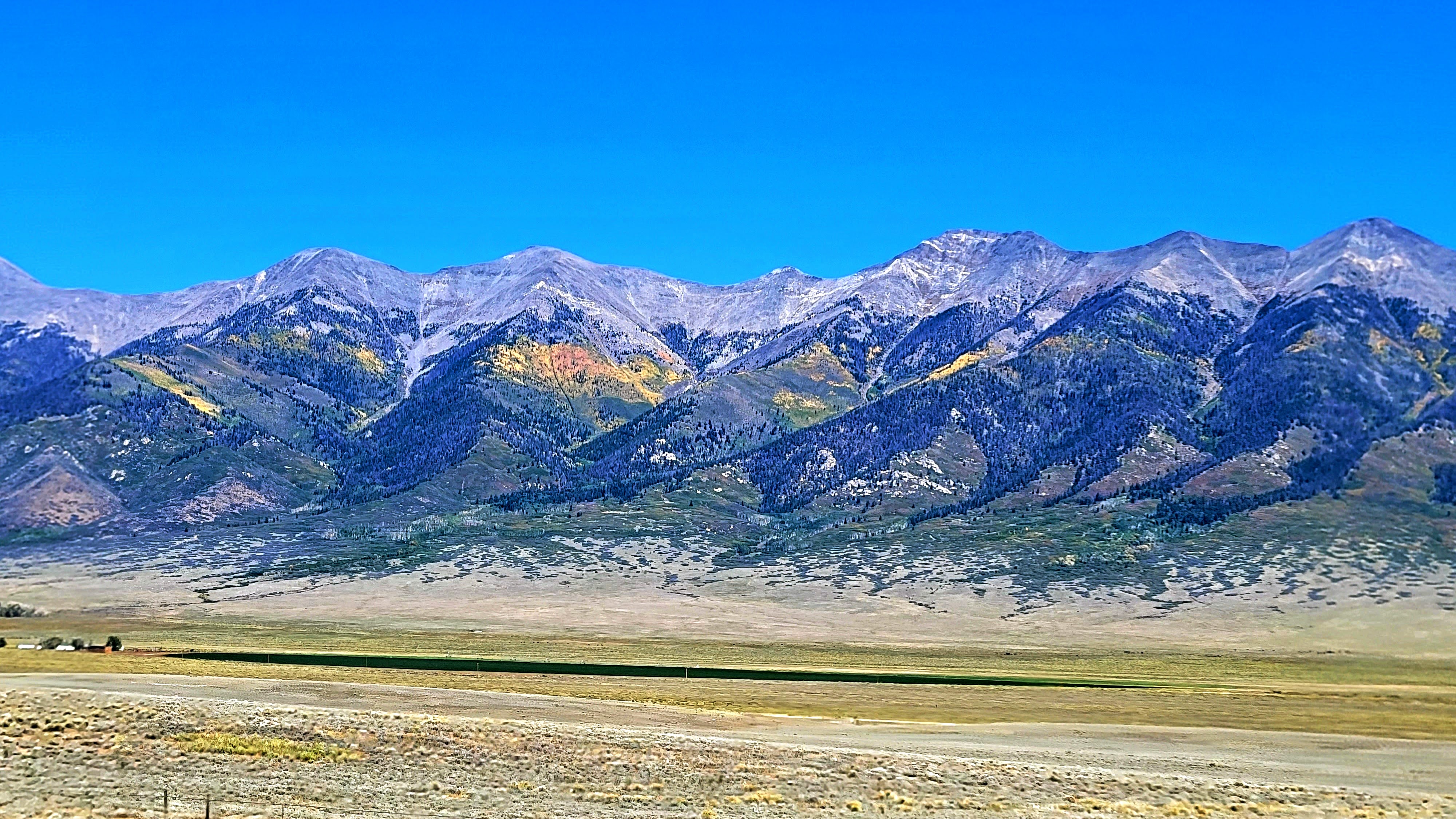
My husband and I had a wonderful anniversary trip to Southern Colorado where we hiked up part of a mountain to see Zapata Waterfall, click here. made our second visit to the Sand Dunes National Park, click here, and rode on the scenic Cumbres and Toltec Railroad to New Mexico, click here. all the while enjoying the scenic views of the 14,000 feet high Sangre De Cristo Mountain Range and the San Luis ValleyAs you can see in the photo above the aspen groves on the mountains were glowing in beautiful autumn colors!
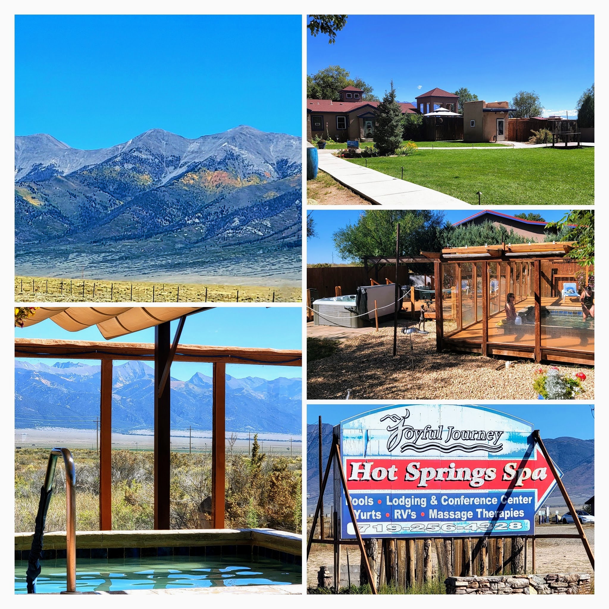


On our drive back to the Denver area, we decided to stop in at the Joyful Journey Spa for a few hours to soak in their natural mineral hot spring pools.


At an elevation of 7700 feet (2346.96 M) on the valley floor, the spa enjoys cool summers and sunny winters, as well as spectacular views of the mountain wilderness to the east. They offer lodge, casita, yurt, or tipi accommodations. They also welcome day visits.


A Hummingbird Moth we saw buzzing around a plant at the spa. 

It was wonderful to soak in the hot springs--the 108-degree pool was our favorite and so relaxing!

After 3 hours of bliss, we went back on the road...


...where we passed the Collegiate Mountain Peaks to the west...


...and then drove through the high (9,000 plus feet) alpine basin of South Park.


As we approached Kenosha Pass more aspen colors began to appear.
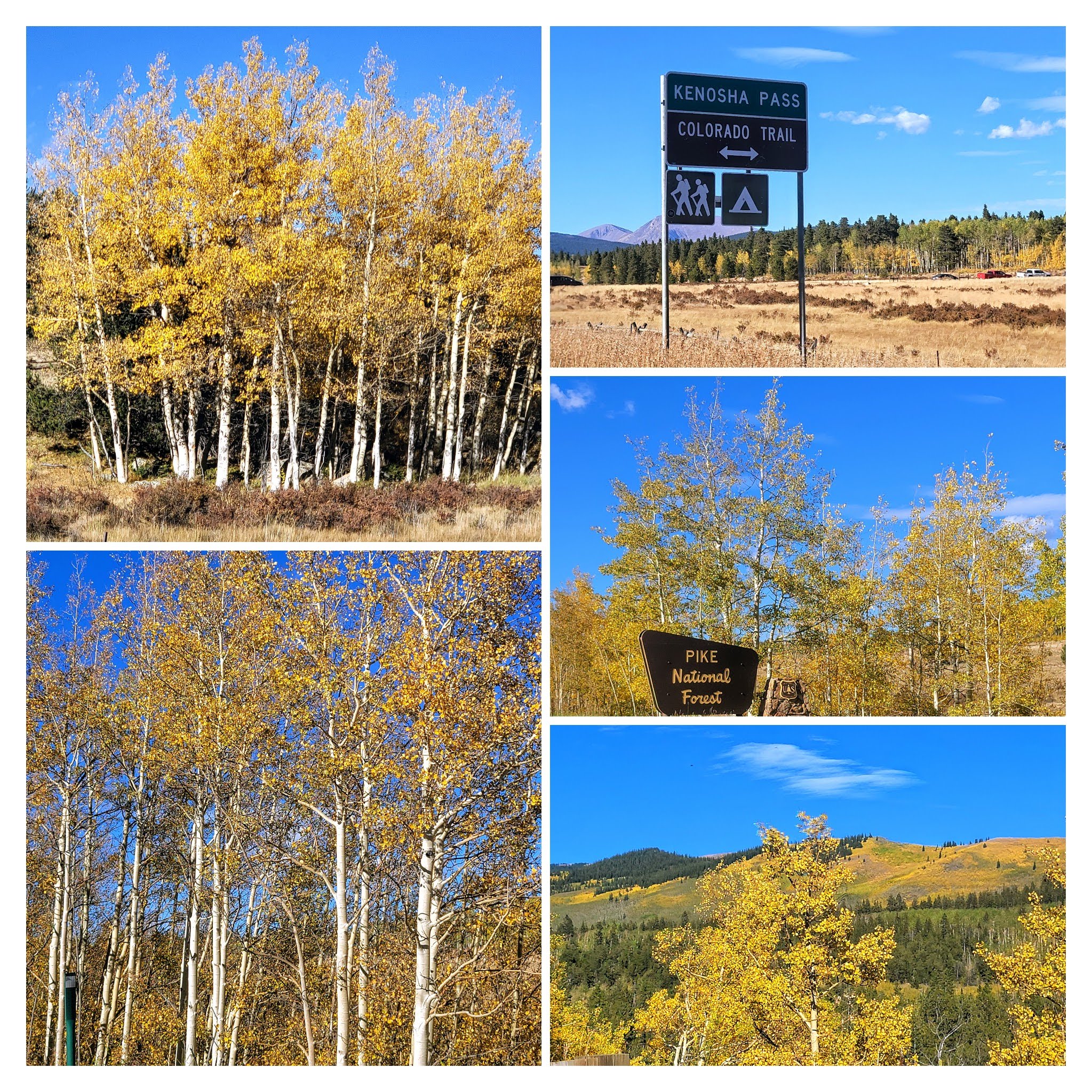


There were so many beautiful views to see as we drove by.


 Colorado is so beautiful in the fall!


We continued our drive home, thankful for another year together and another joyful anniversary celebration.


Please keep one of my favorite bloggers, Marie, of Proud Italian Cook, in your prayers! Marie and I began blogging at the same time in 2007 and she has been an inspirational source for many delicious recipes for me. Marie recently announced on Instagram that she sadly found out that she has advanced ovarian cancer and is now receiving chemotherapy and will have surgery in the future. 

Marie's son is going to compete in the 2023 Boston Marathon and was selected to help raise money for the Dana Farber Cancer Research Center in honor of his mother.  100% of every penny he raises will go towards innovative cancer research to help find a cure. His goal is to raise $26,200, which is $1000 for each of the 26.2 miles he will run on April 17th, 2023 at the Boston Marathon. Please consider supporting this cause with a tax-deductible donation. Here is the link where you can donate if you so choose: 

You can also find me on


Bookmark and Share

Monday, October 17, 2022

The Scenic Cumbres and Toltec Railroad


My husband and I love the adventure of a steam engine railroad ride and we were excited to take a 6-hour ride on the very scenic Cumbres and Toltec Railroad recently, taking the ride from Antonito, Colorado to Chama, New Mexico. 

The train's website describes it perfectly:
"The Cumbres & Toltec Scenic Railroad is a National Historic Landmark.  At 64-miles in length, it is the longest, the highest and most authentic steam railroad in North America, traveling through some of the most spectacular scenery in the Rocky Mountain West.

Owned by the states of Colorado and New Mexico, the train crosses state borders 11 times, zigzagging along canyon walls, burrowing through two tunnels, and steaming over 137-foot Cascade Trestle. All trains steam along through deep forests of aspens and evergreens, across high plains filled with wildflowers, and through a rocky gorge of remarkable geologic formations."


The Cumbres & Toltec Scenic Railroad was originally constructed in 1880 as part of the Rio Grande’s narrow gauge San Juan Extension, which served the silver mining district of the San Juan mountains in southwestern Colorado. The inability to interchange cars with other railroads led the Rio Grande to begin converting its tracks to standard gauge in 1890.  Through the years the line became less and less used and finally abandoned. Happily, railway preservationists had the foresight to save the most scenic portion of the line. In 1970, the states of Colorado and New Mexico jointly purchased the track and line-side structures from Antonito to Chama.


When taking the train from the Antonito, Colorado station we first passed over the vast high-elevation San Luis Valley, which has an average elevation of 7,664 feet (2,336 m) above sea level.  My husband and I went out to the stand-up open car as soon as our tickets were punched as we wanted to see all the scenery. A herd of Pronghorns ran across the tracks in the distance at this point, but they were so fast I couldn't catch a good photo of them.


A short Youtube video I took of the train traveling in the San Luis Valley at the beginning of our ride.


The train quickly covers the flat ground and reaches a series of hills. It crosses Ferguson’s Trestle, named for a man who was hung there. 


It then climbs to a lava mesa, a remnant of the mountain's volcanic past. From here, the route winds around wide curves, going up into the mountains.  


We took the train ride the last week in September, so I was concerned that the fall color would not be very bright as yet, but the higher we went in elevation the more golden the aspens became.


The train track was very close to the edge of the mountain summit cliffs and my husband and I marveled over the construction and all the effort it must have taken to lay all the track.


The train passed by Sublette.  Sublette was the home of station gangs, the workers who maintained the right-of-way ties, ballast, and rails. During early railroad operations, the telegraph and trains were the only communication for folks living there.


We passed through the 342-foot Mud Tunnel which requires wooden supports to hold up the tunnel roof and walls.


We were now in an attractive geologic area of volcanic lava rock.


The views were beautiful!


The autumn color was really popping here.


So many aspen trees!


We really enjoyed the views!


We passed alongside many beautiful aspen groves and views of deep valleys and then entered the 360-foot-long Rock Tunnel which opened up to 600 feet above Toltec Gorge,  To see a video of our exciting ride through the tunnel and our first view of the gorge click here to see my YouTube short.  You can also see the square granite Garfield Monument towards the end of this video.  It was erected by railroad ticket agents and dedicated to the memory of  President James A. Garfield after his assassination in 1881.


If you look in the distance you can see the railroad track along the cliffside, where we had just traveled.  


The train stopped at Osier, Colorado where we were given a delicious cafeteria-style barbecue lunch included in our train ticket.


After lunch, we had a good view of the Rio de Los Pinos River when we were back on board the train.


The train passed over the Cascade Trestle that spanned 137 feet over Cascade Creek.


The train continued on over many curves which helped it gain elevation.


My husband's hand pointed to an eagle flying high overhead!


The train had to work hard to climb up to Cumbres Pass, the highest point on the railroad at 10,015 feet (3,052,5m) above sea level.  The Cumbres and Toltec Railroad travels the highest of any train in North America!  Fierce winter storms sometimes leave snow drifts of 20 feet or more.


More spectacular views!


As the train approached Chama, New Mexico, we were told of its role in some movies, as we passed a prop wooden tower that was used in an Indiana Jones movie in 1989.  When we reached the station we could see another engine and train that will make the trip from Chama to Antonito the next day.  We could also see the coach bus that was waiting to bring us back to Antonito.  The bus ride was also included in our train ticket and only took one hour as it took a very direct, but equally scenic, route.

We really enjoyed our day on the Cumbres and Toltec Railroad and could see why it has been voted the best and most scenic train ride in America by readers of USA Today (2016, 2019, 2020)

If you'd like to see other train rides we've taken in Colorado you can see all ten prior posts at this tab. We have taken the Georgetown Loop many times, The Royal Gorge Railroad twice, the Leadville Colorado and Southern Railroad, and even the Tiny Town miniature railroad and we still have a few more train rides we are looking forward to taking in the future.  I hope you enjoyed taking a virtual trip on this historic and scenic Cumbres and Toltec Railroad with me.

You can also find me on


Bookmark and Share

Monday, October 3, 2022

A Hike to Zapata Falls


Last week my husband and I decided to take a quick trip to Southern Colorado to see some iconic sights as an early anniversary celebration. We usually like to wait until early October to do a long drive as fall arrives early in Colorado and the aspens begin to turn gold. Autumn is my favorite season as I love the cooler temperatures and beautiful colors of nature.


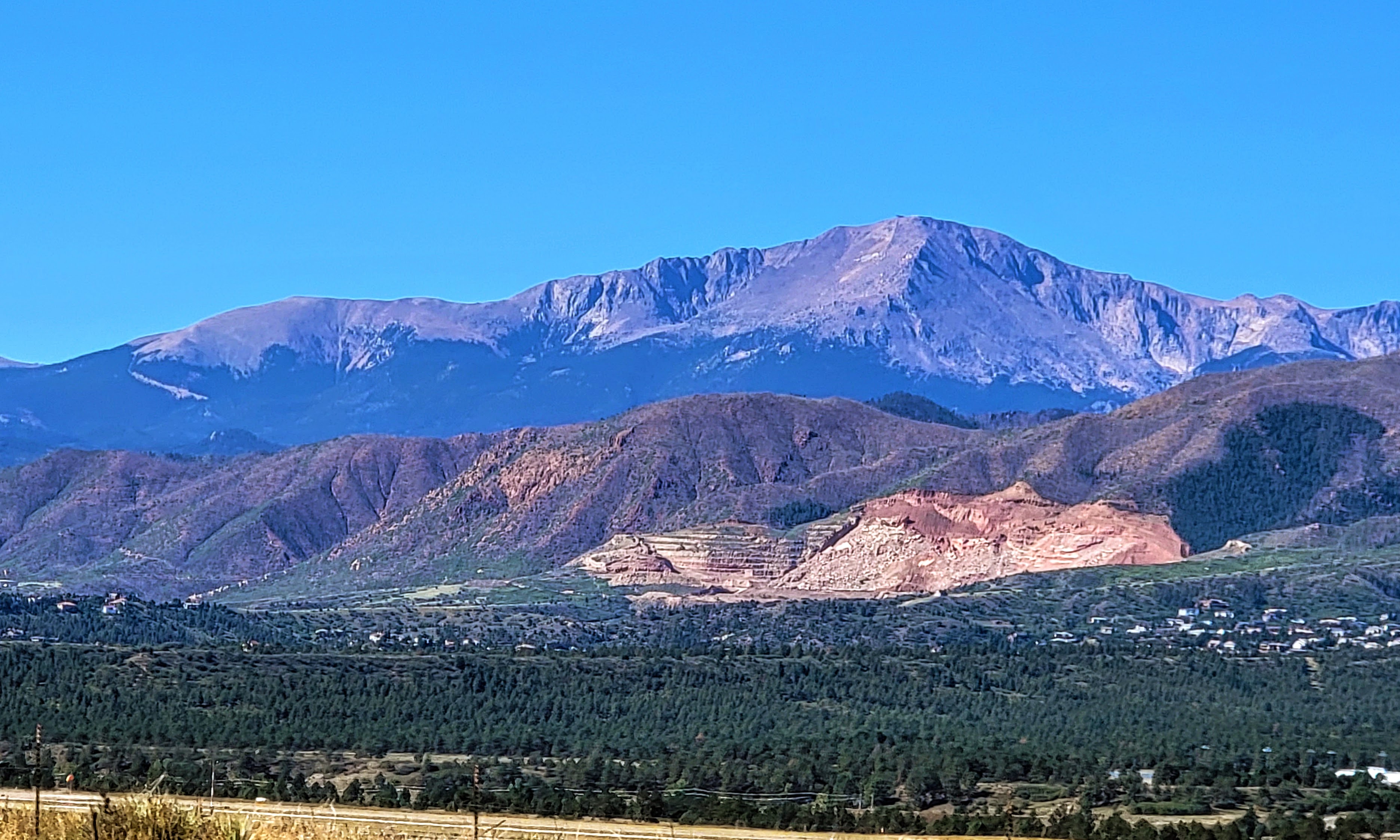
We drove past Pikes Peak also known as "America's Mountain" 

Pikes Peak is a 14,115-ft. pink granite peak featuring hiking trails with stunning views, climbing & campgrounds.  You can read a post about our first drive up to the mountain's summit on this link, and our last trip in 2021 when many changes were taking place at the summit--click here--to see that post.


As we continued driving south we finally reached the San Luis Valley which is rimmed by the Sangre de Cristo Mountain Range. A view of Mount Blanca is above,  It is the fourth highest summit of the Rocky Mountains in Colorado, and at 14,351 feet (4,374 m) it is the highest summit of the Sangre de Cristo Range.  

I blogged about this beautiful peak in a prior post, in which I also explained why Navajo Native Americans consider the peak sacred--click here--to read that post


We could see some colorful aspens on some of the mountains' higher elevations.


We visited this part of Colorado a few years ago but did not have a chance on that trip to hike up to see Zapata Falls, so this time we wanted to accomplish that task. We soon approached the Zapata Falls Recreation Area

Zapata Falls is a waterfall located near the base of the Sangre de Cristo Mountains on Bureau of Land Management land adjacent to Rio Grande National Forest and south of Great Sand Dunes National Park.


As we drove up the road leading to the parking lot beyond the Zapata Falls Campground area we had a wonderful view of a part of the San Luis Valley.

The San Luis Valley is over 50 miles wide and over 100 miles long, at 8,192 square feet (21,000 km) with an average elevation of 7,664 feet (2,336 m) above sea level. It is larger than some American states!


Please click on the collage above twice to enlarge it fully for an easy view of the placard information at the trailhead.

We parked our car and began to hike, passing the informational signs above.  They explained that the hike ahead would be a half mile each way, and have a 400-foot elevation to 9,400 feet. They also explain how the area is a moraine formed by a glacier two million years ago.


Please click on the collage  to enlarge it for a full-view

The hike up was very rocky and soon followed alongside the South Zapata Creek


At certain points, the cold creek had to be crossed over to continue the hike.


As you can see and hear in my video above the creek water was running fast and loud!


It was slow going for us as we were trying to be very careful not to fall on the slippery rocks. I did fall once but was able to recover quickly without getting too wet.


We saw younger and more agile hikers taking different approaches along the rock walls of the slot canyon. At one point my husband thought we should turn back, but I was determined that since we came this far we should keep going.


We were glad we did keep going! 

As you can see from the video above the thunderous 25-foot-long waterfall was pounding down inside a slot canyon.  Be sure to look all the way to the top.  We felt we could not go in any further to get a full view as the water was cold and getting deeper, so I leaned in as far as possible to get this video on my phone.


This area is just as impressive during the winter months when the falls freeze into an enormous column of ice!  Our daughter did this hike in early spring when the falls were frozen yet still could be heard running underneath the thick ice.


It was exciting for us to have made it this far!


Considering that it was almost October the falls were still fairly full.  I imagine in late spring they would be even more full and really roaring with snow melt!


After recrossing the creek a few times we began the rocky half-mile walk back down to our car 


Again, the view of the San Luis Valley, with the San Juan Mountain Range in the distance was spectacular!  Such wide open flat, yet elevated land!


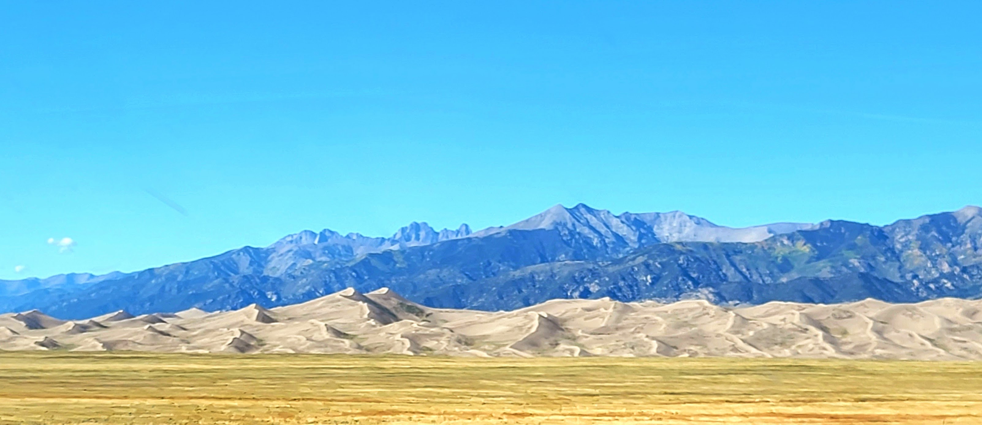
We also had a view of the Great Sand Dunes National Paek in the distance.  They are the tallest sand dunes in North America!

The dunes cover an area of about 30 sq mi (78 km) and are estimated to contain over 1.2 cubic miles (5 billion cubic meters) of sand.


Please click on the collage above twice to enlarge the 
two informational placards about the dunes at the overlook.


Come back to my blog next week to learn more about the sand dunes--they are a spectacular sight!


You can also find me on