Showing posts with label Great Sand Dunes National Park. Show all posts

Sunday, October 9, 2022

The Great Sand Dunes National Park in Fall


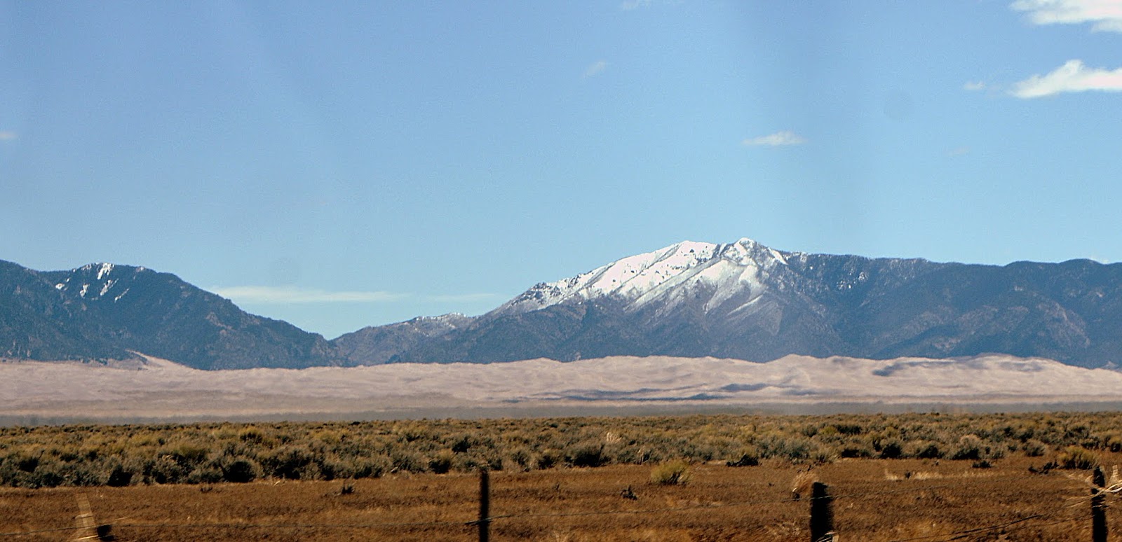
A distant view of the Great Sand Dunes National Park and Preserve in Colorado as we drove up to visit them. They are the highest sand dunes in North America and quite an amazing sight to see!  The dune field encompasses 30 square miles (7.77 square meters) and at its highest is 750 feet (228.6 meters). This was our second visit to see them since moving to Colorado. Our first visit was in Spring and this visit was in Fall, both wonderful times of the year to view the dunes. My first blog post about our drive to see them in 2016 and our first impressions can be read on this link.  My part two blog post about our attempt to climb up a dune and also a video of the sound of the wind that was blowing across the dunes can be read on this link.


The dunes and surrounding area were designated a National Monument in 1932. In the year 2000, United States President Bill Clinton signed the Great Sand Dunes National Park and Preserve Act. The federal government purchased 97,000 acres of the Baca Ranch which tripled the size of the park and preserved the land and water drainage for future generations to enjoy.


Earlier, we had hiked to the top of nearby Zapata Falls --click here--to read that blog post, so it was already close to the closing hour of the visitor center, but we stopped in anyway.


There are wonderful panoramic views of the sand dunes from the visitor's center back porch.


The dunes are believed to be 440,000 years old in the high-elevation desert of the San Luis Valley at 7,694 feet (2,345 meters).  The dunes were formed by the right combinations of wind, water, and sediment. Creeks and streams brought large amounts of sediment and sand into the valley.  The wind then blew the sand toward the bend in the Sangre de Christo Mountains, where opposing storm winds helped squeeze the sand into the tall dunes seen today.  


Please click on the photo above to enlarge it.


We were surprised to see Medano Creek, which runs in front of the sand dunes was still running even though it was October.  In spring snow melt from the Sangre de Cristo Mountains makes this creek run strong 


        . 


If you look at this YouTube--click here--from the National Park service you can see how the creek looks in spring--it actually has waves!


The size of the people standing in front of the dunes gives a better perspective as to how enormous they are!  Often visitors rent special sandboards from local vendors and slide down the dunes. You can learn more about that on this link.


hr


They are truly a wonder!

Recently, exciting news was announced that The United States Department of the Interior and The Nature Conservancy announced that TNC’s nearby Medano-Zapata Ranch will transfer 9,362 acres of land to the Great Sand Dunes National Park and Preserve.


As we drove out of the park the slant of the setting sun gave the dunes a pretty golden glow,

We were happy to have seen them again!


My husband and I were staying in the town of Alamosa that night--it is about 30 minutes away from the Great Sand Dunes National Park and we had dinner at a newly opened Italian-style restaurant called The Friar's Fork that I read about in the Colorado Magazine 5280 at this link.  The husband and wife owners had worked for many top restaurants and resorts and wanted to open their own place. They found a deconsecrated 1926 Episcopalian church that had been empty for a couple of years, bought it, and renovated it into a restaurant and cafe. Our meal was so delicious!  I had the Chicken Marsala and my husband had a special, Beef Osso Bucco.  It was the perfect early anniversary celebration for us!

The next day we were headed south to the town of Antonito, where we had a reservation to take a ride on the Cumbres and Toltec Railroad, called by USA Today Magazine "The Best Train Ride in America"I will blog about that train ride next week.

You can also find me on


Bookmark and Share

Sunday, May 15, 2016

The Great Sand Dunes National Park, Part Two


In my last post (click here to read that post) I brought you to our recent visit to The Great Sand Dunes National Park and Preserve, located in southern Colorado.  It is one of four national parks located in Colorado. The others are the Rocky Mountain National Park, which we've visited multiple times, Mesa Verde National Park, and The Black Canyon of the Gunnison National Parkwhich we have visited once, but hope to also see again many times.  Each park contains magnificent beauty and diverse geologic and ecologic features, while Meas Verde showed the marvels of ancient native civilization structures in a vast canyon's walls. My husband and I have visited many other USA National Parks over the years, and many more are on our list to see. We are happy that our country has preserved these wonders of nature for future generations to see! (All photos will enlarge if clicked on)


The Great Sand Dunes National Park has to be one of the most unusual parks to visit. It is far from large cities and accessibility can be challenging. There is a visitor center on-site with bathrooms, and there are limited motels/hotels near the park and some campgrounds in and around the park.  We drove from the Denver area to the park in about 4 hours and after visiting the Great Sand Dunes National Park we stayed the night in a hotel in the town of Alamosa, around 38 miles away.


The visitors center for the park is at 8,200 feet elevation at the base of the dunes, so not only do you have to prepare for the elevation, but the fact that weather in the park can be very variable. There are often high winds in spring, and March and April are the snowiest months. In summer, the air temperature can reach 80 degrees F, while the temperature of the sand on the dunes can reach 150 degrees F. In summer after the sun goes down, the air temperature can drop to 40 degrees F.

But don't let these challenges defray you from planning a visit to the park. Probably late spring or early fall are the optimal times to come, and if you come in summer plan on an early morning visit before the heat of the day. You can check the park's weather on this link.


The Medano Creek that runs in front of the dunes is only seen in early to late spring, as it is the result of snowmelt in the mountains. Our visit was at the end of April, so the creek was still shallow enough for us to walk across with our shoes on, but it increases in-depth as the season goes on and children often delight in swimming and playing in it.


I ended my Part One post with our reaching Medano Creek, and now I'll take you forward as we approach the dunes.


It was interesting to see the different qualities of the sand as we walked toward the dunes.  The sand close to the creek was full of rocks and pebbles.


A close-up

This sand is made up mainly from the close to the Sangre de Cristo Mountains, and therefore between the wind and water, larger particles of sand and pebbles accumulate.


The closer you walk to the dunes the sand becomes fine-grained and very deep and soft. You can see how people's footprints sink into the sand.


Most of the 30 miles of sand dune field are made up of sand originating from the far westerly San Juan Mountains. From there it was washed by streams into the vast San Luis Valley. From there southwesterly winds blew, bounced, and pushed the grains up against the Sangre de Christo Mountains, where they formed the tallest sand dune formations in North America!


I was excited to begin our hike!  Here the dunes are ahead...


....and from the same point is my husband with Medano Creek behind him.


In the distance, you can see the tops of the 14,000-foot the San Juan Mountains in the distance to the left, and the vast sand dune field all around us.


 People in the foreground look like tiny specks on the sand.


As we climb in elevation the challenge of walking on the dunes becomes more and more apparent to us.


There are many hills and crests to conquer and we begin to feel defeated by both the soft sand grabbing at our ankles like quicksand, and the constant wind whipping around us


The elevation of the dunes seemed never-ending.


I would catch glimpses of people reaching the top, which would spur me on...


But my husband and I were beginning to realize we probably would not be able to reach the zenith of the top dunes, as we were struggling with fatigue.


At that point, we stopped and just took in the beauty of the height we reached.


We looked in all directions and felt exalted by this wonder of nature!


Mountains were all around us, both far and near.


So, how far did we hike? If you enlarge the photo above you can see I marked the dune we stopped on with an "x"  It took us about an hour and a half to reach this point.


Here I am at that point--my face is red from the intense sun, wind, and exertion of walking in soft sand.  Below is a video I posted on my Mille Fiori Favoriti Facebook page from that place on the dunes. Click here to go to the Facebook page if you do not see the video plugin below.


As you can hear in the video, the wind was strong on the day of our visit and it was one of the factors that inhibited our hike. I was worried about sand blowing into my eyes and lungs. I think I'd be better prepared if I return again by wearing more wrap-around sunglasses and bringing a face mask and tie on sun hat.  Although the park claims it is less windy than the city of Chicago, Spring is often the windy season.


Still, I was thrilled that we made it as far on our hike as we did and that I enjoyed these magnificent sights!


It felt like we were in another world, and seeing sights I never dreamed I would see!


On our way back toward the bottom of the dunes, we stopped for a few minutes to watch both children and adults use special sandboards to ride down the dunes, both sledding and sandboarding.


Sitting on the board to ride down a dune looked like fun! The special boards have to be rented or bought at nearby retailers--they are NOT available in the park. Click here to read about rentals.


I took one last look at where I had hoped to hike, as I knew that the entire dune field could be seen from the very top of the highest dunes.  Maybe on my next visit, I'll be able to get there.


We were still very happy to have accomplished what we did and enjoy our first visit to The Great Sand Dune National Park and Preserve. They are ever-changing, but always staying the same, totally unique and unexpected.

After our overnight stay in Alamosa, we journeyed east towards the vast plains of Colorado, where we wanted to visit two more National Historic sites. More about those interesting and poignant places in a future post!


Bookmark and Share

Monday, May 9, 2016

The Great Sand Dunes National Park, Part One


I really do believe I live in one of the prettiest and most amazing states! Be prepared to see some beautiful Colorado scenery and an outstanding natural phenomenon! My husband and I decided to take a four-hour car ride to southern Colorado to see The Great Sand Dunes National Park a couple weekends ago.  We began our journey on US 285 over Kenosha Pass--where the sight of South Park--a flat 9,000 to 10,000-foot altitude grassland basin--never fails to amaze me! (All photos in this post will enlarge if clicked on)


The distant Rocky Mountain peaks in South Park were surrounded by misty fog in the early morning sun, and patches of snow could still be seen in some of the shady spots on the vast grasslands.


As we drove west we could see the grass beginning to become green again with the warmer spring weather.


As always, the sight of the Collegiate Peaks of the Sawatch Range of the Rocky Mountains, near the town of Buena Vista, is a magnificent sight to see!


As we drive south on US 285 the beautiful Sangre de Cristo Mountain Range appears.


Soon, off into the distance, we can see the long sand dune formations at the base of the mountains. These sand dunes began forming over 400,000 thousand years ago and are the highest sand dunes in North America.


At this distance, they seem small compared to the 13,000-foot Sangre de Cristo mountains looming above them, but the dunes reach up to 750 feet in height!


The dunes formation begins in the San Luis Valley, which is a broad plain between the San Juan Mountains on the west (seen in the photo above) and the Sangre de Cristo Mountains on the east. Streams and creeks flowing out of the San Juan Mountains over the millennia carried gravel and sand into shallow lakes in the San Luis Valley. During drought periods, these lakes dried, releasing sand particles into the wind.


Strong prevailing southwesterly winds carry the grains of sand toward the Sangre de Cristo Mountains and pile them up against the foothills, resulting in the sand dune formations covering more than 30 square miles. As you can see in the photo above, we could actually notice the sand blowing east off the valley floor.


We traveled south on CO-17 and then east on lane 6 N and CO-150 North towards...


After seeing the dunes in the distance for a long time while we drove, it was thrilling to finally be approaching them.


The full measure of their height and length was amazing.


We stopped at the park's visitors center where we watched a 20-minute movie about the sand dunes formation and the park's history.


There was a beautiful panorama of the dunes from the visitor's center back porch...


Click to enlarge


..and many interesting placards to read about the history of the area and the preservation efforts.


The dunes and surrounding area were designated a National Monument in 1932. In the year 2000, United States President Bill Clinton signed the Great Sand Dunes National Park and Preserve Act. The federal government purchased 97,000 acres of the Baca Ranch which tripled the size of the park and preserved the land and water drainage for future generations to enjoy.


One of the fascinating features of the park is the seasonal Medano Creek that runs in front of the dunes.


Medano Creek's depth and duration are directly linked to the snowpack in the mountains above the dunes.


 At the time we visited the creek was flowing in a steady stream...


...but it was still shallow enough in places to cross while still wearing shoes if one was careful.


It wound around in ripples...


...shallow...


...to deep!


The creek extended far in the distance...


 ...and was a barrier to cross before walking towards the dunes. 

The fantastic thing is that Medano Creek only appears in spring and by summer disappears below the sand and is no longer visible.  I'm glad we were able to see it!


Imagine playing sand volleyball at the base of a snow-capped mountain in Colorado? 


Come back next post, to see part two, and I'll show you what it is like to walk up the dunes!


The Great Sand Dunes National Park and Preserve--a wonder of the world and a Colorado treasure!


Bookmark and Share